Weather Warnings Archive: Tuesday 11 Nov 2025 10:09 GMT - UK


00:00-06:00

06:00-12:00

12:00-18:00

18:00-24:00


Severe Weather Warnings: Rain
issued by the Metoffice at
10:09, 11.11.2025
valid from
07:00, 11.11.2025
until
23:59, 11.11.2025
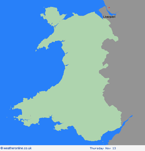
Region: Wales
Outbreaks of rain arriving from the west during Tuesday morning will become heavy and persistent at times, especially but not exclusively over south facing hills, and accompanied by increasingly strong southerly winds. 30-50 mm of rain is likely fairly widely, with 60-80 mm of rain building up in the wettest spots over south facing hills. Much of this could come in heavy bursts during Tuesday afternoon and early evening. Although likely fading fairly by late Tuesday night, rainfall could resume early Wednesday, although details become increasingly low confidence. This warning may be extended tomorrow or a fresh warning issued for Wednesday morning should confidence in a wetter scenario increase. Given recent wet weather, and saturated ground in places, this could lead to some flooding in places. Difficult travelling conditions for the evening commute are also expected, with delays and the increased possibility of accidents. What Should I Do? Check if your property could be at risk of flooding. If so, consider preparing a flood plan and an emergency flood kit. Give yourself the best chance of avoiding delays by checking road conditions if driving, or bus and train timetables, amending your travel plans if necessary. People cope better with power cuts when they have prepared for them in advance. It’s easy to do; consider gathering torches and batteries, a mobile phone power pack and other essential items. Be prepared for weather warnings to change quickly: when a weather warning is issued, the Met Office recommends staying up to date with the weather forecast in your area.
Chief ForecasterHeavy rain during Tuesday afternoon and evening could lead to some flooding and disruption in places.
The public is advised to take extra care, further information and advice can be found here: http://www.metoffice.gov.uk/weather/uk/links.html
