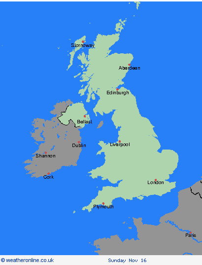
Weather Warnings Archive: Wednesday 12 Nov 2025 20:18 GMT - UK


00:00-06:00

06:00-12:00

12:00-18:00

18:00-24:00


Severe Weather Warnings: Rain
issued by the Metoffice at
20:18, 12.11.2025
valid from
00:00, 13.11.2025
until
11:00, 13.11.2025
Region: Strathclyde
An area of rain, heavy in places, will move northwards across northern England overnight before slowly decaying over southern Scotland Thursday morning. This is likely to bring fairly widespread totals of 15-25 mm, particularly over the far north of England and southern Scotland where a few places may receive 40-50 mm, before easing from the south. What Should I Do? Check if your property could be at risk of flooding. If so, consider preparing a flood plan and an emergency flood kit. Give yourself the best chance of avoiding delays by checking road conditions if driving, or bus and train timetables, amending your travel plans if necessary. People cope better with power cuts when they have prepared for them in advance. It’s easy to do; consider gathering torches and batteries, a mobile phone power pack and other essential items. Be prepared for weather warnings to change quickly: when a weather warning is issued, the Met Office recommends staying up to date with the weather forecast in your area.
Chief ForecasterPersistent and at times heavy rain leading to some disruption on Thursday morning
The public is advised to take extra care, further information and advice can be found here: http://www.metoffice.gov.uk/weather/uk/links.html
Severe Weather Warnings: Rain
issued by the Metoffice at
20:18, 12.11.2025
valid from
00:00, 13.11.2025
until
11:00, 13.11.2025
Region: SW Scotland, Lothian Borders
An area of rain, heavy in places, will move northwards across northern England overnight before slowly decaying over southern Scotland Thursday morning. This is likely to bring fairly widespread totals of 15-25 mm, particularly over the far north of England and southern Scotland where a few places may receive 40-50 mm, before easing from the south. What Should I Do? Check if your property could be at risk of flooding. If so, consider preparing a flood plan and an emergency flood kit. Give yourself the best chance of avoiding delays by checking road conditions if driving, or bus and train timetables, amending your travel plans if necessary. People cope better with power cuts when they have prepared for them in advance. It’s easy to do; consider gathering torches and batteries, a mobile phone power pack and other essential items. Be prepared for weather warnings to change quickly: when a weather warning is issued, the Met Office recommends staying up to date with the weather forecast in your area.
Chief ForecasterPersistent and at times heavy rain leading to some disruption on Thursday morning
The public is advised to take extra care, further information and advice can be found here: http://www.metoffice.gov.uk/weather/uk/links.html
Severe Weather Warnings: Rain
issued by the Metoffice at
20:18, 12.11.2025
valid from
06:00, 12.11.2025
until
23:59, 12.11.2025
Region: Wales
After heavy rain on Tuesday and overnight, further rain, heavy at times, is expected to move north during Wednesday. There is a good chance a further 15-25 mm of rain falling quite widely through the remainder of Wednesday and some exposed locations, most likely on south facing hills, could see 30-40 mm of rain. With widely wet antecedent conditions there is an increased risk of flooding in some areas. What Should I Do? Check if your property could be at risk of flooding. If so, consider preparing a flood plan and an emergency flood kit. Give yourself the best chance of avoiding delays by checking road conditions if driving, or bus and train timetables, amending your travel plans if necessary. People cope better with power cuts when they have prepared for them in advance. It’s easy to do; consider gathering torches and batteries, a mobile phone power pack and other essential items. Be prepared for weather warnings to change quickly: when a weather warning is issued, the Met Office recommends staying up to date with the weather forecast in your area.
Chief ForecasterFurther rain on Wednesday to bring some travel disruption and flooding
The public is advised to take extra care, further information and advice can be found here: http://www.metoffice.gov.uk/weather/uk/links.html
Severe Weather Warnings: Rain
issued by the Metoffice at
20:18, 12.11.2025
valid from
00:00, 13.11.2025
until
11:00, 13.11.2025
Region: North West England
An area of rain, heavy in places, will move northwards across northern England overnight before slowly decaying over southern Scotland Thursday morning. This is likely to bring fairly widespread totals of 15-25 mm, particularly over the far north of England and southern Scotland where a few places may receive 40-50 mm, before easing from the south. What Should I Do? Check if your property could be at risk of flooding. If so, consider preparing a flood plan and an emergency flood kit. Give yourself the best chance of avoiding delays by checking road conditions if driving, or bus and train timetables, amending your travel plans if necessary. People cope better with power cuts when they have prepared for them in advance. It’s easy to do; consider gathering torches and batteries, a mobile phone power pack and other essential items. Be prepared for weather warnings to change quickly: when a weather warning is issued, the Met Office recommends staying up to date with the weather forecast in your area.
Chief ForecasterPersistent and at times heavy rain leading to some disruption on Thursday morning
The public is advised to take extra care, further information and advice can be found here: http://www.metoffice.gov.uk/weather/uk/links.html
Severe Weather Warnings: Rain
issued by the Metoffice at
20:18, 12.11.2025
valid from
00:00, 13.11.2025
until
11:00, 13.11.2025
Region: North East England
An area of rain, heavy in places, will move northwards across northern England overnight before slowly decaying over southern Scotland Thursday morning. This is likely to bring fairly widespread totals of 15-25 mm, particularly over the far north of England and southern Scotland where a few places may receive 40-50 mm, before easing from the south. What Should I Do? Check if your property could be at risk of flooding. If so, consider preparing a flood plan and an emergency flood kit. Give yourself the best chance of avoiding delays by checking road conditions if driving, or bus and train timetables, amending your travel plans if necessary. People cope better with power cuts when they have prepared for them in advance. It’s easy to do; consider gathering torches and batteries, a mobile phone power pack and other essential items. Be prepared for weather warnings to change quickly: when a weather warning is issued, the Met Office recommends staying up to date with the weather forecast in your area.
Chief ForecasterPersistent and at times heavy rain leading to some disruption on Thursday morning
The public is advised to take extra care, further information and advice can be found here: http://www.metoffice.gov.uk/weather/uk/links.html
Severe Weather Warnings: Rain/Wind
issued by the Metoffice at
20:18, 12.11.2025
valid from
12:00, 11.11.2025
until
18:00, 12.11.2025
Region: South West England
Outbreaks of light rain on Tuesday morning are expected to turn heavier and more persistent during Tuesday afternoon, accompanied by a strengthening southerly wind; gusts exceeding gale force are possible along exposed south facing coastal districts and over hills. Although wind and rain will likely ease later Tuesday evening, further pulses of persistent and/or heavy rain could continue overnight and through much of Wednesday as the associated weather system becomes slow moving. 20-40 mm is likely fairly widely, with 60-80 mm building up in the wettest spots, these most likely but not exclusively on the south facing slopes of the moors. Given recent wet weather, and saturated ground in places, this could lead to flooding in a few spots. More generally, difficult driving conditions are likely for the Tuesday evening commute in particular, with delays due to slow traffic and the increased possibility of accidents. What Should I Do? Check if your property could be at risk of flooding. If so, consider preparing a flood plan and an emergency flood kit. Give yourself the best chance of avoiding delays by checking road conditions if driving, or bus and train timetables, amending your travel plans if necessary. People cope better with power cuts when they have prepared for them in advance. It’s easy to do; consider gathering torches and batteries, a mobile phone power pack and other essential items. Be prepared for weather warnings to change quickly: when a weather warning is issued, the Met Office recommends staying up to date with the weather forecast in your area.
Chief ForecasterHeavy rain accompanied by strong southerly winds, will give difficult driving conditions and may produce flooding in places.
The public is advised to take extra care, further information and advice can be found here: http://www.metoffice.gov.uk/weather/uk/links.html
