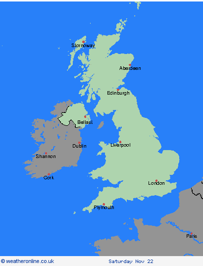
Weather Warnings Archive: Wednesday 19 Nov 2025 10:36 GMT - UK


00:00-06:00

06:00-12:00

12:00-18:00

18:00-24:00


Severe Weather Warnings: Snow/Ice
issued by the Metoffice at
10:36, 19.11.2025
valid from
18:00, 18.11.2025
until
21:00, 20.11.2025
Region: Orkney & Shetland
Snow showers will feed inland on brisk northerly winds from late Tuesday through Wednesday and into Thursday, giving significant accumulations in places. Whilst there will be a lot of regional variation in amounts, where showers are most frequent 2-5 cm will be possible at low levels, with 5-10 cm on hills above about 100 m elevation, and potentially as much as 15-20 cm above 300 m. Gusty winds and perhaps a few lightning strikes may accompany some of the showers, posing as additional hazards. Where showers persist and/or snow partially thaws and then refreezes overnight, this will bring a risk of ice. What Should I Do? Snowy, wintry weather can cause delays and make driving conditions dangerous, so to keep yourself and others safe: plan your route, checking for delays and road closures, amending your travel plans if necessary; if driving, leave more time to prepare and check your car before setting off; make sure you have essentials packed in your car in the event of any delays (warm clothing, food, water, a blanket, a torch, ice scraper/de-icer, a warning triangle, high visibility vest and an in-car phone charger). Keep yourself and your family safe when it is icy. Plan to leave the house at least five minutes earlier than normal to reduce your risk of accidents, slips, and falls. If making a journey on foot, try to use pavements along main roads which are likely to be less slippery. Similarly, if cycling, try and stick to main roads which are more likely to have been treated. People cope better when they have prepared in advance for the risk of power cuts or being cut off from services and amenities due to the snow. It’s easy to do; consider gathering torches and batteries, a mobile phone power pack and other essential items. Be prepared for weather warnings to change quickly: when a weather warning is issued, the Met Office recommends staying up to date with the weather forecast in your area.
Chief ForecasterFrequent snow showers from late Tuesday through Wednesday and Thursday may lead to some disruption
The public is advised to take extra care, further information and advice can be found here: http://www.metoffice.gov.uk/weather/uk/links.html
Severe Weather Warnings: Snow/Ice
issued by the Metoffice at
10:36, 19.11.2025
valid from
18:00, 18.11.2025
until
21:00, 20.11.2025
Region: Highland & Eilean Siar
Snow showers will feed inland on brisk northerly winds from late Tuesday through Wednesday and into Thursday, giving significant accumulations in places. Whilst there will be a lot of regional variation in amounts, where showers are most frequent 2-5 cm will be possible at low levels, with 5-10 cm on hills above about 100 m elevation, and potentially as much as 15-20 cm above 300 m. Gusty winds and perhaps a few lightning strikes may accompany some of the showers, posing as additional hazards. Where showers persist and/or snow partially thaws and then refreezes overnight, this will bring a risk of ice. What Should I Do? Snowy, wintry weather can cause delays and make driving conditions dangerous, so to keep yourself and others safe: plan your route, checking for delays and road closures, amending your travel plans if necessary; if driving, leave more time to prepare and check your car before setting off; make sure you have essentials packed in your car in the event of any delays (warm clothing, food, water, a blanket, a torch, ice scraper/de-icer, a warning triangle, high visibility vest and an in-car phone charger). Keep yourself and your family safe when it is icy. Plan to leave the house at least five minutes earlier than normal to reduce your risk of accidents, slips, and falls. If making a journey on foot, try to use pavements along main roads which are likely to be less slippery. Similarly, if cycling, try and stick to main roads which are more likely to have been treated. People cope better when they have prepared in advance for the risk of power cuts or being cut off from services and amenities due to the snow. It’s easy to do; consider gathering torches and batteries, a mobile phone power pack and other essential items. Be prepared for weather warnings to change quickly: when a weather warning is issued, the Met Office recommends staying up to date with the weather forecast in your area.
Chief ForecasterFrequent snow showers from late Tuesday through Wednesday and Thursday may lead to some disruption
The public is advised to take extra care, further information and advice can be found here: http://www.metoffice.gov.uk/weather/uk/links.html
Severe Weather Warnings: Snow/Ice
issued by the Metoffice at
10:36, 19.11.2025
valid from
18:00, 18.11.2025
until
21:00, 20.11.2025
Region: Grampian
Snow showers will feed inland on brisk northerly winds from late Tuesday through Wednesday and into Thursday, giving significant accumulations in places. Whilst there will be a lot of regional variation in amounts, where showers are most frequent 2-5 cm will be possible at low levels, with 5-10 cm on hills above about 100 m elevation, and potentially as much as 15-20 cm above 300 m. Gusty winds and perhaps a few lightning strikes may accompany some of the showers, posing as additional hazards. Where showers persist and/or snow partially thaws and then refreezes overnight, this will bring a risk of ice. What Should I Do? Snowy, wintry weather can cause delays and make driving conditions dangerous, so to keep yourself and others safe: plan your route, checking for delays and road closures, amending your travel plans if necessary; if driving, leave more time to prepare and check your car before setting off; make sure you have essentials packed in your car in the event of any delays (warm clothing, food, water, a blanket, a torch, ice scraper/de-icer, a warning triangle, high visibility vest and an in-car phone charger). Keep yourself and your family safe when it is icy. Plan to leave the house at least five minutes earlier than normal to reduce your risk of accidents, slips, and falls. If making a journey on foot, try to use pavements along main roads which are likely to be less slippery. Similarly, if cycling, try and stick to main roads which are more likely to have been treated. People cope better when they have prepared in advance for the risk of power cuts or being cut off from services and amenities due to the snow. It’s easy to do; consider gathering torches and batteries, a mobile phone power pack and other essential items. Be prepared for weather warnings to change quickly: when a weather warning is issued, the Met Office recommends staying up to date with the weather forecast in your area.
Chief ForecasterFrequent snow showers from late Tuesday through Wednesday and Thursday may lead to some disruption
The public is advised to take extra care, further information and advice can be found here: http://www.metoffice.gov.uk/weather/uk/links.html
Severe Weather Warnings: Snow/Ice
issued by the Metoffice at
10:36, 19.11.2025
valid from
18:00, 18.11.2025
until
21:00, 20.11.2025
Region: Strathclyde
Snow showers will feed inland on brisk northerly winds from late Tuesday through Wednesday and into Thursday, giving significant accumulations in places. Whilst there will be a lot of regional variation in amounts, where showers are most frequent 2-5 cm will be possible at low levels, with 5-10 cm on hills above about 100 m elevation, and potentially as much as 15-20 cm above 300 m. Gusty winds and perhaps a few lightning strikes may accompany some of the showers, posing as additional hazards. Where showers persist and/or snow partially thaws and then refreezes overnight, this will bring a risk of ice. What Should I Do? Snowy, wintry weather can cause delays and make driving conditions dangerous, so to keep yourself and others safe: plan your route, checking for delays and road closures, amending your travel plans if necessary; if driving, leave more time to prepare and check your car before setting off; make sure you have essentials packed in your car in the event of any delays (warm clothing, food, water, a blanket, a torch, ice scraper/de-icer, a warning triangle, high visibility vest and an in-car phone charger). Keep yourself and your family safe when it is icy. Plan to leave the house at least five minutes earlier than normal to reduce your risk of accidents, slips, and falls. If making a journey on foot, try to use pavements along main roads which are likely to be less slippery. Similarly, if cycling, try and stick to main roads which are more likely to have been treated. People cope better when they have prepared in advance for the risk of power cuts or being cut off from services and amenities due to the snow. It’s easy to do; consider gathering torches and batteries, a mobile phone power pack and other essential items. Be prepared for weather warnings to change quickly: when a weather warning is issued, the Met Office recommends staying up to date with the weather forecast in your area.
Chief ForecasterFrequent snow showers from late Tuesday through Wednesday and Thursday may lead to some disruption
The public is advised to take extra care, further information and advice can be found here: http://www.metoffice.gov.uk/weather/uk/links.html
Severe Weather Warnings: Snow/Ice
issued by the Metoffice at
10:36, 19.11.2025
valid from
18:00, 18.11.2025
until
21:00, 20.11.2025
Region: Central, Tayside & Fife
Snow showers will feed inland on brisk northerly winds from late Tuesday through Wednesday and into Thursday, giving significant accumulations in places. Whilst there will be a lot of regional variation in amounts, where showers are most frequent 2-5 cm will be possible at low levels, with 5-10 cm on hills above about 100 m elevation, and potentially as much as 15-20 cm above 300 m. Gusty winds and perhaps a few lightning strikes may accompany some of the showers, posing as additional hazards. Where showers persist and/or snow partially thaws and then refreezes overnight, this will bring a risk of ice. What Should I Do? Snowy, wintry weather can cause delays and make driving conditions dangerous, so to keep yourself and others safe: plan your route, checking for delays and road closures, amending your travel plans if necessary; if driving, leave more time to prepare and check your car before setting off; make sure you have essentials packed in your car in the event of any delays (warm clothing, food, water, a blanket, a torch, ice scraper/de-icer, a warning triangle, high visibility vest and an in-car phone charger). Keep yourself and your family safe when it is icy. Plan to leave the house at least five minutes earlier than normal to reduce your risk of accidents, slips, and falls. If making a journey on foot, try to use pavements along main roads which are likely to be less slippery. Similarly, if cycling, try and stick to main roads which are more likely to have been treated. People cope better when they have prepared in advance for the risk of power cuts or being cut off from services and amenities due to the snow. It’s easy to do; consider gathering torches and batteries, a mobile phone power pack and other essential items. Be prepared for weather warnings to change quickly: when a weather warning is issued, the Met Office recommends staying up to date with the weather forecast in your area.
Chief ForecasterFrequent snow showers from late Tuesday through Wednesday and Thursday may lead to some disruption
The public is advised to take extra care, further information and advice can be found here: http://www.metoffice.gov.uk/weather/uk/links.html
Severe Weather Warnings: Snow/Ice
issued by the Metoffice at
10:36, 19.11.2025
valid from
00:00, 19.11.2025
until
23:59, 20.11.2025
Region: SW Scotland, Lothian Borders
Wintry showers feeding inland from the North Sea through Wednesday and Thursday may give some snow accumulations in places, especially farther inland away from the immediate windward coast. Whilst there will be a lot of regional variation, with some places seeing little or no lying snow, where showers are most frequent accumulations of 2-5 cm are possible. However, the North York Moors, and perhaps parts of the Yorkshire Wolds, could potentially receive 15-25 cm of snow by Thursday, leading to some significant disruption. Gusty winds and perhaps a few lightning strikes may accompany some of the showers, posing as additional hazards. Where showers persist and/or snow partially thaws and then refreezes overnight, this will bring a risk of ice. What Should I Do? Snowy, wintry weather can cause delays and make driving conditions dangerous, so to keep yourself and others safe: plan your route, checking for delays and road closures, amending your travel plans if necessary; if driving, leave more time to prepare and check your car before setting off; make sure you have essentials packed in your car in the event of any delays (warm clothing, food, water, a blanket, a torch, ice scraper/de-icer, a warning triangle, high visibility vest and an in-car phone charger). People cope better when they have prepared in advance for the risk of power cuts or being cut off from services and amenities due to the snow. It’s easy to do; consider gathering torches and batteries, a mobile phone power pack and other essential items. Keep yourself and your family safe when it is icy. Plan to leave the house at least five minutes earlier than normal to reduce your risk of accidents, slips, and falls. If making a journey on foot, try to use pavements along main roads which are likely to be less slippery. Similarly, if cycling, try and stick to main roads which are more likely to have been treated. Be prepared for weather warnings to change quickly: when a weather warning is issued, the Met Office recommends staying up to date with the weather forecast in your area.
Chief ForecasterWintry showers feeding inland from the North Sea through Wednesday and Thursday may lead to some disruption
The public is advised to take extra care, further information and advice can be found here: http://www.metoffice.gov.uk/weather/uk/links.html
Severe Weather Warnings: Snow/Ice
issued by the Metoffice at
10:36, 19.11.2025
valid from
12:00, 19.11.2025
until
23:59, 20.11.2025
Region: Wales
Wintry showers will feed southwards across southwest Wales and parts of Devon and Cornwall through Wednesday and Thursday, moving well inland on brisk northerly winds. Some snow accumulations will be possible in places, especially overnight and/or farther inland away from the immediate windward coast. Whilst some places will see little or no lying snow, where showers are most frequent accumulations of 2-5 cm are possible, and perhaps up to 10 cm in a few isolated spots, more especially on hills above 200 m elevation in Pembrokeshire and west Carmarthenshire. Gusty winds and hail may accompany some of the showers, and where showers persist and/or snow partially thaws and refreezes overnight, this will bring a risk of ice. What Should I Do? Snowy, wintry weather can cause delays and make driving conditions dangerous, so to keep yourself and others safe: plan your route, checking for delays and road closures, amending your travel plans if necessary; if driving, leave more time to prepare and check your car before setting off; make sure you have essentials packed in your car in the event of any delays (warm clothing, food, water, a blanket, a torch, ice scraper/de-icer, a warning triangle, high visibility vest and an in-car phone charger). Keep yourself and your family safe when it is icy. Plan to leave the house at least five minutes earlier than normal to reduce your risk of accidents, slips, and falls. If making a journey on foot, try to use pavements along main roads which are likely to be less slippery. Similarly, if cycling, try and stick to main roads which are more likely to have been treated. Give yourself the best chance of avoiding delays by checking road conditions if driving, or bus and train timetables, amending your travel plans if necessary. People cope better with power cuts when they have prepared for them in advance. It’s easy to do; consider gathering torches and batteries, a mobile phone power pack and other essential items. Be prepared for weather warnings to change: when a weather warning is issued, the Met Office recommends staying up to date with the weather forecast in your area.
Chief ForecasterWintry showers feeding southwards through Wednesday and Thursday may lead to some disruption
The public is advised to take extra care, further information and advice can be found here: http://www.metoffice.gov.uk/weather/uk/links.html
Severe Weather Warnings: Snow/Ice
issued by the Metoffice at
10:36, 19.11.2025
valid from
00:00, 19.11.2025
until
23:59, 20.11.2025
Region: North East England
Wintry showers feeding inland from the North Sea through Wednesday and Thursday may give some snow accumulations in places, especially farther inland away from the immediate windward coast. Whilst there will be a lot of regional variation, with some places seeing little or no lying snow, where showers are most frequent accumulations of 2-5 cm are possible. However, the North York Moors, and perhaps parts of the Yorkshire Wolds, could potentially receive 15-25 cm of snow by Thursday, leading to some significant disruption. Gusty winds and perhaps a few lightning strikes may accompany some of the showers, posing as additional hazards. Where showers persist and/or snow partially thaws and then refreezes overnight, this will bring a risk of ice. What Should I Do? Snowy, wintry weather can cause delays and make driving conditions dangerous, so to keep yourself and others safe: plan your route, checking for delays and road closures, amending your travel plans if necessary; if driving, leave more time to prepare and check your car before setting off; make sure you have essentials packed in your car in the event of any delays (warm clothing, food, water, a blanket, a torch, ice scraper/de-icer, a warning triangle, high visibility vest and an in-car phone charger). People cope better when they have prepared in advance for the risk of power cuts or being cut off from services and amenities due to the snow. It’s easy to do; consider gathering torches and batteries, a mobile phone power pack and other essential items. Keep yourself and your family safe when it is icy. Plan to leave the house at least five minutes earlier than normal to reduce your risk of accidents, slips, and falls. If making a journey on foot, try to use pavements along main roads which are likely to be less slippery. Similarly, if cycling, try and stick to main roads which are more likely to have been treated. Be prepared for weather warnings to change quickly: when a weather warning is issued, the Met Office recommends staying up to date with the weather forecast in your area.
Chief ForecasterWintry showers feeding inland from the North Sea through Wednesday and Thursday may lead to some disruption
The public is advised to take extra care, further information and advice can be found here: http://www.metoffice.gov.uk/weather/uk/links.html
Severe Weather Warnings: Snow
issued by the Metoffice at
10:36, 19.11.2025
valid from
03:00, 20.11.2025
until
21:00, 20.11.2025
Region: North East England
Frequent wintry showers will feed inland from the North Sea, giving significant snow accumulations over the North York Moors and parts of the Yorkshire Wolds. By the end of Thursday, as much as 15-25 cm may have accumulated on hills above 100 m elevation, which is likely to cause substantial disruption. Gusty winds, giving occasional blizzard conditions, and perhaps a few lightning strikes, may accompany some of the showers, posing as additional hazards. What Should I Do? It is safer not to drive in these conditions, but if you need to make an essential journey, consider alternative forms of transport, to keep you and others safe. If you must drive, do this more safely by: using dipped headlights; accelerating gently, using low revs and changing to higher gears as quickly as possible; starting in second gear to help with wheel slip; maintaining a safe and steady speed, keeping distance from other vehicles; using a low gear to go downhill, avoiding braking unless necessary; steering into skids, not taking your hands of the wheel, and avoiding slamming on brakes. People cope better with power cuts when they have prepared for them in advance. It’s easy to do; consider gathering torches and batteries, a mobile phone power pack and other essential items. If isolated due to snow, follow these simple steps to keep safe and well: keep the thermostat set to the same temperature both during the day and at night; turn off electrical heaters and put out your fire before going to bed; ensure pets are safe by keeping them warm and comfortable; prevent frozen pipes by opening kitchen and bathroom cabinet doors to allow warmer air to circulate around the plumbing; stay indoors, wrap up warm and close internal doors to keep the heat in; and, if you need support call the British Red Cross Support Line on 0808 196 3651. Help to protect vulnerable people that you know including older people, those with underlying conditions and those who live alone; they may need support with food and medical supplies. If you are worried about your health or that of somebody you know, ring NHS 111 (or consult NI:DIRECT if in Northern Ireland). Stay up to date with the weather forecast for your area and follow advice from emergency services and local authorities.
Chief ForecasterFrequent wintry showers, leading to significant snow accumulations, are likely to cause disruption on Thursday
The public is advised to take extra care, further information and advice can be found here: http://www.metoffice.gov.uk/weather/uk/links.html
Severe Weather Warnings: Snow/Ice
issued by the Metoffice at
10:36, 19.11.2025
valid from
00:00, 19.11.2025
until
23:59, 20.11.2025
Region: Yorkshire & Humber
Wintry showers feeding inland from the North Sea through Wednesday and Thursday may give some snow accumulations in places, especially farther inland away from the immediate windward coast. Whilst there will be a lot of regional variation, with some places seeing little or no lying snow, where showers are most frequent accumulations of 2-5 cm are possible. However, the North York Moors, and perhaps parts of the Yorkshire Wolds, could potentially receive 15-25 cm of snow by Thursday, leading to some significant disruption. Gusty winds and perhaps a few lightning strikes may accompany some of the showers, posing as additional hazards. Where showers persist and/or snow partially thaws and then refreezes overnight, this will bring a risk of ice. What Should I Do? Snowy, wintry weather can cause delays and make driving conditions dangerous, so to keep yourself and others safe: plan your route, checking for delays and road closures, amending your travel plans if necessary; if driving, leave more time to prepare and check your car before setting off; make sure you have essentials packed in your car in the event of any delays (warm clothing, food, water, a blanket, a torch, ice scraper/de-icer, a warning triangle, high visibility vest and an in-car phone charger). People cope better when they have prepared in advance for the risk of power cuts or being cut off from services and amenities due to the snow. It’s easy to do; consider gathering torches and batteries, a mobile phone power pack and other essential items. Keep yourself and your family safe when it is icy. Plan to leave the house at least five minutes earlier than normal to reduce your risk of accidents, slips, and falls. If making a journey on foot, try to use pavements along main roads which are likely to be less slippery. Similarly, if cycling, try and stick to main roads which are more likely to have been treated. Be prepared for weather warnings to change quickly: when a weather warning is issued, the Met Office recommends staying up to date with the weather forecast in your area.
Chief ForecasterWintry showers feeding inland from the North Sea through Wednesday and Thursday may lead to some disruption
The public is advised to take extra care, further information and advice can be found here: http://www.metoffice.gov.uk/weather/uk/links.html
Severe Weather Warnings: Snow
issued by the Metoffice at
10:36, 19.11.2025
valid from
03:00, 20.11.2025
until
21:00, 20.11.2025
Region: Yorkshire & Humber
Frequent wintry showers will feed inland from the North Sea, giving significant snow accumulations over the North York Moors and parts of the Yorkshire Wolds. By the end of Thursday, as much as 15-25 cm may have accumulated on hills above 100 m elevation, which is likely to cause substantial disruption. Gusty winds, giving occasional blizzard conditions, and perhaps a few lightning strikes, may accompany some of the showers, posing as additional hazards. What Should I Do? It is safer not to drive in these conditions, but if you need to make an essential journey, consider alternative forms of transport, to keep you and others safe. If you must drive, do this more safely by: using dipped headlights; accelerating gently, using low revs and changing to higher gears as quickly as possible; starting in second gear to help with wheel slip; maintaining a safe and steady speed, keeping distance from other vehicles; using a low gear to go downhill, avoiding braking unless necessary; steering into skids, not taking your hands of the wheel, and avoiding slamming on brakes. People cope better with power cuts when they have prepared for them in advance. It’s easy to do; consider gathering torches and batteries, a mobile phone power pack and other essential items. If isolated due to snow, follow these simple steps to keep safe and well: keep the thermostat set to the same temperature both during the day and at night; turn off electrical heaters and put out your fire before going to bed; ensure pets are safe by keeping them warm and comfortable; prevent frozen pipes by opening kitchen and bathroom cabinet doors to allow warmer air to circulate around the plumbing; stay indoors, wrap up warm and close internal doors to keep the heat in; and, if you need support call the British Red Cross Support Line on 0808 196 3651. Help to protect vulnerable people that you know including older people, those with underlying conditions and those who live alone; they may need support with food and medical supplies. If you are worried about your health or that of somebody you know, ring NHS 111 (or consult NI:DIRECT if in Northern Ireland). Stay up to date with the weather forecast for your area and follow advice from emergency services and local authorities.
Chief ForecasterFrequent wintry showers, leading to significant snow accumulations, are likely to cause disruption on Thursday
The public is advised to take extra care, further information and advice can be found here: http://www.metoffice.gov.uk/weather/uk/links.html
Severe Weather Warnings: Snow/Ice
issued by the Metoffice at
10:36, 19.11.2025
valid from
12:00, 19.11.2025
until
23:59, 20.11.2025
Region: South West England
Wintry showers will feed southwards across southwest Wales and parts of Devon and Cornwall through Wednesday and Thursday, moving well inland on brisk northerly winds. Some snow accumulations will be possible in places, especially overnight and/or farther inland away from the immediate windward coast. Whilst some places will see little or no lying snow, where showers are most frequent accumulations of 2-5 cm are possible, and perhaps up to 10 cm in a few isolated spots, more especially on hills above 200 m elevation in Pembrokeshire and west Carmarthenshire. Gusty winds and hail may accompany some of the showers, and where showers persist and/or snow partially thaws and refreezes overnight, this will bring a risk of ice. What Should I Do? Snowy, wintry weather can cause delays and make driving conditions dangerous, so to keep yourself and others safe: plan your route, checking for delays and road closures, amending your travel plans if necessary; if driving, leave more time to prepare and check your car before setting off; make sure you have essentials packed in your car in the event of any delays (warm clothing, food, water, a blanket, a torch, ice scraper/de-icer, a warning triangle, high visibility vest and an in-car phone charger). Keep yourself and your family safe when it is icy. Plan to leave the house at least five minutes earlier than normal to reduce your risk of accidents, slips, and falls. If making a journey on foot, try to use pavements along main roads which are likely to be less slippery. Similarly, if cycling, try and stick to main roads which are more likely to have been treated. Give yourself the best chance of avoiding delays by checking road conditions if driving, or bus and train timetables, amending your travel plans if necessary. People cope better with power cuts when they have prepared for them in advance. It’s easy to do; consider gathering torches and batteries, a mobile phone power pack and other essential items. Be prepared for weather warnings to change: when a weather warning is issued, the Met Office recommends staying up to date with the weather forecast in your area.
Chief ForecasterWintry showers feeding southwards through Wednesday and Thursday may lead to some disruption
The public is advised to take extra care, further information and advice can be found here: http://www.metoffice.gov.uk/weather/uk/links.html


19.11.2025