Weather Warnings Archive: Sunday 04 Jan 2026 12:00 GMT - UK


00:00-06:00

06:00-12:00

12:00-18:00

18:00-24:00


Severe Weather Warnings: Snow/Ice
issued by the Metoffice at
12:00, 04.01.2026
valid from
00:00, 03.01.2026
until
23:59, 05.01.2026
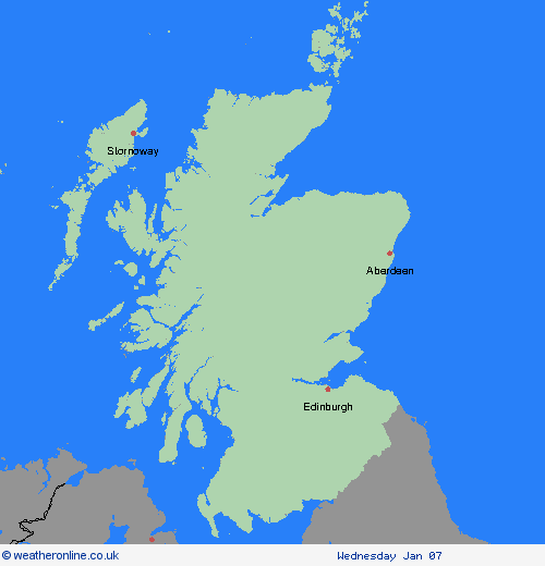
Region: Grampian
Snow showers will continue through Sunday, being brought well inland by strong northerly winds. Showers will become increasingly confined to the far north of Scotland by Monday afternoon but an ice risk will remain across many areas into Monday evening before a spell of more organised snow arrives in the west later. The most frequent showers and highest accumulations are expected over the northwest Highlands, Grampian but also Aberdeenshire where 5-10 cm is likely to fall fairly widely with a few places seeing 20-30 cm. Elsewhere, snow accumulations will be smaller, typically no more than 2-5 cm. Strong winds during Sunday may cause further drifting of snow and temporary blizzard conditions. What Should I Do? Snowy, wintry weather can cause delays and make driving conditions dangerous, so to keep yourself and others safe: plan your route, checking for delays and road closures, amending your travel plans if necessary; if driving, leave more time to prepare and check your car before setting off; make sure you have essentials packed in your car in the event of any delays (warm clothing, food, water, a blanket, a torch, ice scraper/de-icer, a warning triangle, high visibility vest and an in-car phone charger). People cope better when they have prepared in advance for the risk of power cuts or being cut off from services and amenities due to the snow. It’s easy to do; consider gathering torches and batteries, a mobile phone power pack and other essential items. Be prepared for weather warnings to change quickly: when a weather warning is issued, the Met Office recommends staying up to date with the weather forecast in your area.
Chief ForecasterFrequent and heavy snow showers will bring further accumulations of snow and ice which may cause travel disruption and delays.
The public is advised to take extra care, further information and advice can be found here: http://www.metoffice.gov.uk/weather/uk/links.html
Severe Weather Warnings: Snow
issued by the Metoffice at
12:00, 04.01.2026
valid from
18:00, 04.01.2026
until
10:00, 05.01.2026
Region: Grampian
Heavy snow showers will become more frequent and may merge to give longer spells of snow at times. The areas and period covered by this warning are when the heaviest and most disruptive snow is thought most likely during the current cold spell, with existing yellow warnings covering a wider area and a longer period. Further accumulations of 5-10 cm is likely to fall fairly widely, with a few places seeing 20-30 cm over mainland Scotland. Strong winds at times may cause further drifting of snow and temporary blizzard conditions. What Should I Do? Snowy, wintry weather can cause delays and make driving conditions dangerous, so to keep yourself and others safe: plan your route, checking for delays and road closures, amending your travel plans if necessary; if driving, leave more time to prepare and check your car before setting off; make sure you have essentials packed in your car in the event of any delays (warm clothing, food, water, a blanket, a torch, ice scraper/de-icer, a warning triangle, high visibility vest and an in-car phone charger). People cope better when they have prepared in advance for the risk of power cuts or being cut off from services and amenities due to the snow. It’s easy to do; consider gathering torches and batteries, a mobile phone power pack and other essential items. Be prepared for weather warnings to change quickly: when a weather warning is issued, the Met Office recommends staying up to date with the weather forecast in your area.
Chief ForecasterHeavy snow showers becoming more frequent which will lead to some travel disruption on Sunday night and Monday morning
The public is advised to take extra care, further information and advice can be found here: http://www.metoffice.gov.uk/weather/uk/links.html
Severe Weather Warnings: Snow/Ice
issued by the Metoffice at
12:00, 04.01.2026
valid from
00:00, 06.01.2026
until
23:59, 06.01.2026
Region: Grampian
An area of snow is likely to move east across central and northern Scotland during Tuesday. 2-5 cm of additional snow could accumulate quite widely, though 10-15 cm may build up on ground above 200 metres, particularly in the west and north of the warning area, with a few places possibly seeing around 20 cm fall. Freezing levels may temporarily lift for a time, allowing snow to turn to sleet or rain at lower elevations, before lowering again by the evening, with further snow showers likely returning to northern Scotland by the evening. Precipitation is likely to fall on to frozen surfaces, particularly during Tuesday morning, bringing the potential for widespread icy conditions to develop. What Should I Do? Snowy, wintry weather can cause delays and make driving conditions dangerous, so to keep yourself and others safe: plan your route, checking for delays and road closures, amending your travel plans if necessary; if driving, leave more time to prepare and check your car before setting off; make sure you have essentials packed in your car in the event of any delays (warm clothing, food, water, a blanket, a torch, ice scraper/de-icer, a warning triangle, high visibility vest and an in-car phone charger). People cope better when they have prepared in advance for the risk of power cuts or being cut off from services and amenities due to the snow. It’s easy to do; consider gathering torches and batteries, a mobile phone power pack and other essential items. Keep yourself and your family safe when it is icy. Plan to leave the house at least five minutes earlier than normal to reduce your risk of accidents, slips, and falls. If making a journey on foot, try to use pavements along main roads which are likely to be less slippery. Similarly, if cycling, try and stick to main roads which are more likely to have been treated. Give yourself the best chance of avoiding delays by checking road conditions if driving, or bus and train timetables, amending your travel plans if necessary. Be prepared for weather warnings to change quickly: when a weather warning is issued, the Met Office recommends staying up to date with the weather forecast in your area.
Chief ForecasterSnow and ice is likely to bring some disruption, particularly to travel.
The public is advised to take extra care, further information and advice can be found here: http://www.metoffice.gov.uk/weather/uk/links.html


04.01.2026