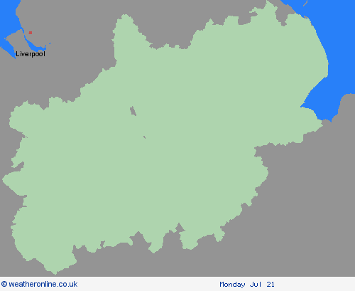
Weather Warnings Archive: Friday 18 Jul 2025 10:54 BST - UK


Severe Weather Warnings: Thunderstorms
issued by the Metoffice at
09:54, 18.07.2025
valid from
00:00, 19.07.2025
until
21:00, 19.07.2025
Region: East Midlands
Areas of heavy rain with embedded thunderstorms will move northwestwards across a large swathe of central and eastern England through Friday night into Saturday. Rain will likely be torrential in places, bringing 20-30 mm in less than an hour, with 60-90 mm in 2-3 hours possible in a few places. Whilst more widespread heavy rain will gradually clear northwestwards during Saturday, additional scattered heavy showers and thunderstorms may develop in its wake during Saturday afternoon and early evening, before eventually decaying later. What Should I Do? Consider if your location is at risk of flash flooding. If so, consider preparing a flood plan and an emergency flood kit. Prepare to protect your property and people from injury. Before gusty winds arrive, check to ensure moveable objects or temporary structures are well secured. Items include; bins, garden furniture, trampolines, tents, gazebos, sheds, and fences. Give yourself the best chance of avoiding delays by checking road conditions if driving, or bus and train timetables, amending your travel plans if necessary. People cope better with power cuts when they have prepared for them in advance. It’s easy to do; consider gathering torches and batteries, a mobile phone power pack and other essential items. If you find yourself outside and hear thunder, protect yourself by finding a safe enclosed shelter (such as a car). Do not shelter under or near trees, or other structures which may be struck by lightning. If you are on an elevated area move to lower ground. Be prepared for weather warnings to change quickly: when a weather warning is issued, the Met Office recommends staying up to date with the weather forecast in your area.
Chief ForecasterHeavy rain, with some thunderstorms, may lead to disruption in places on Friday night and through much of Saturday
The public is advised to take extra care, further information and advice can be found here: http://www.metoffice.gov.uk/weather/uk/links.html
Severe Weather Warnings: Thunderstorms
issued by the Metoffice at
09:54, 18.07.2025
valid from
11:00, 18.07.2025
until
20:00, 18.07.2025
Region: East Midlands
Showers and thunderstorms will develop early on Friday afternoon, before becoming concentrated across parts of northeast England. 15-25 mm of rain is possible in less than an hour, and should storms become aligned across similar areas, 40-60 mm of rain is possible, with these higher totals most likely over East Yorkshire and the North York Moors. As well as rain, frequent lightning and large hail are possible. Storms will ease and clear into the North Sea Friday evening. What Should I Do? Consider if your location is at risk of flash flooding. If so, consider preparing a flood plan and an emergency flood kit. Give yourself the best chance of avoiding delays by checking road conditions if driving, or bus and train timetables, amending your travel plans if necessary. People cope better with power cuts when they have prepared for them in advance. It’s easy to do; consider gathering torches and batteries, a mobile phone power pack and other essential items. If you find yourself outside and hear thunder, protect yourself by finding a safe enclosed shelter (such as a car). Do not shelter under or near trees, or other structures which may be struck by lightning. If you are on an elevated area move to lower ground. Be prepared for weather warnings to change quickly: when a weather warning is issued, the Met Office recommends staying up to date with the weather forecast in your area.
Chief ForecasterThunderstorms bring the potential for the disruption to transport and infrastructure through Friday afternoon and evening.
The public is advised to take extra care, further information and advice can be found here: http://www.metoffice.gov.uk/weather/uk/links.html
18.07.2025


