Weather Warnings Archive: Tuesday 06 Jan 2026 19:31 GMT - UK


00:00-06:00

06:00-12:00

12:00-18:00

18:00-24:00


Severe Weather Warnings: Ice
issued by the Metoffice at
19:31, 06.01.2026
valid from
19:31, 06.01.2026
until
10:00, 07.01.2026
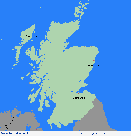
Region: Central, Tayside & Fife
Following a band of precipitation which clears southeast overnight, clear skies will develop for many areas on Tuesday night, leading to icy patches on untreated wet surfaces. This could lead to some minor disruption,especially on Wednesday morning. What Should I Do? Keep yourself and your family safe when it is icy. Plan to leave the house at least five minutes earlier than normal. Not needing to rush, reduces your risk of accidents, slips, and falls. If you need to make a journey on foot, try to use pavements along main roads which are likely to be less slippery. Similarly, if cycling, try and stick to main roads which are more likely to have been treated. Give yourself the best chance of avoiding delays by checking road conditions if driving, or bus and train timetables, amending your travel plans if necessary. Be prepared for weather warnings to change: when a weather warning is issued, the Met Office recommends staying up to date with the weather forecast in your area.
Chief ForecasterIcy patches overnight Tuesday into Wednesday morning could lead to some disruption.
The public is advised to take extra care, further information and advice can be found here: http://www.metoffice.gov.uk/weather/uk/links.html
Severe Weather Warnings: Snow/Ice
issued by the Metoffice at
19:31, 06.01.2026
valid from
00:00, 07.01.2026
until
23:59, 07.01.2026
Region: Central, Tayside & Fife
An area of snow is likely to persist across northern Scotland during Wednesday, spreading down the east coast through the day. This falling as rain or sleet at low elevations, especially around coasts, but is likely to fall on to frozen surfaces, bringing the potential for widespread icy conditions to continue. A further 5-10 cm of snow is likely to fall fairly widely over higher ground above 100 m, but there is a chance some areas above 200 m could see a further 20 cm. Strong winds could lead to continued drifting or blowing snow in places. Accumulations over lower elevations, coastal areas, and over Orkney and Harris are expected to be lower, but ice is expected to remain a hazard on Wednesday morning and again on Wednesday night, particularly where snow melts during the day and refreezes overnight. What Should I Do? Snowy, wintry weather can cause delays and make driving conditions dangerous, so to keep yourself and others safe: plan your route, checking for delays and road closures, amending your travel plans if necessary; if driving, leave more time to prepare and check your car before setting off; make sure you have essentials packed in your car in the event of any delays (warm clothing, food, water, a blanket, a torch, ice scraper/de-icer, a warning triangle, high visibility vest and an in-car phone charger). People cope better when they have prepared in advance for the risk of power cuts or being cut off from services and amenities due to the snow. It’s easy to do; consider gathering torches and batteries, a mobile phone power pack and other essential items. Keep yourself and your family safe when it is icy. Plan to leave the house at least five minutes earlier than normal to reduce your risk of accidents, slips, and falls. If making a journey on foot, try to use pavements along main roads which are likely to be less slippery. Similarly, if cycling, try and stick to main roads which are more likely to have been treated. Give yourself the best chance of avoiding delays by checking road conditions if driving, or bus and train timetables, amending your travel plans if necessary. Be prepared for weather warnings to change quickly: when a weather warning is issued, the Met Office recommends staying up to date with the weather forecast in your area.
Chief ForecasterSnow and ice is likely to bring further disruption on Wednesday.
The public is advised to take extra care, further information and advice can be found here: http://www.metoffice.gov.uk/weather/uk/links.html
Severe Weather Warnings: Snow/Ice
issued by the Metoffice at
19:31, 06.01.2026
valid from
00:00, 06.01.2026
until
11:00, 06.01.2026
Region: Central, Tayside & Fife
An area of mainly light snow will move east across southern Scotland into northern England on Tuesday morning before largely fading and clearing during Tuesday afternoon. A few heavier bursts are possible over the Southern Uplands, the Lake District and the northern Pennines. Most places will see no more than 1-2 cm of snow but a few places over higher ground in the Lake District, northern Pennines and Southern Uplands may see up to 5 cm. This will fall onto frozen surfaces resulting in some icy conditions and could lead to some disruption, particularly to travel over higher routes in the north of the warning area. What Should I Do? Snowy, wintry weather can cause delays and make driving conditions dangerous. Keep yourself and others safe by planning your route, giving yourself extra time for your journey. Check for road closures or delays to public transport and amend plans if necessary. If driving, make sure you have some essentials in your car in the event of any delays (e.g., warm clothing, food, water, a blanket, a torch, ice scraper/de icer, a warning triangle, high visibility vest and an in-car phone charger). Be prepared for weather warnings to change quickly: when a weather warning is issued, the Met Office recommends staying up to date with the weather forecast in your area.
Chief ForecasterSnow and ice may cause some disruption on Tuesday morning, particularly to travel.
The public is advised to take extra care, further information and advice can be found here: http://www.metoffice.gov.uk/weather/uk/links.html
Severe Weather Warnings: Snow/Ice
issued by the Metoffice at
19:31, 06.01.2026
valid from
00:00, 06.01.2026
until
23:59, 06.01.2026
Region: Central, Tayside & Fife
An area of snow is likely to move east across central and northern Scotland during Tuesday. Freezing levels may temporarily lift for a time, allowing snow to turn to sleet or rain at lower elevations, before lowering again, with further snow showers likely returning to northern Scotland by the evening. A further 2-5 cm of snow is likely to fall fairly widely, but there is a chance some areas could see a further 10-15 cm, particularly over higher ground above around 200 metres. Accumulations over the Northern Isles are expected to be lower, but ice is expected to remain a hazard on Tuesday morning and again on Tuesday night. Precipitation is likely to fall on to frozen surfaces, particularly during Tuesday morning, bringing the potential for widespread icy conditions to develop. What Should I Do? Snowy, wintry weather can cause delays and make driving conditions dangerous, so to keep yourself and others safe: plan your route, checking for delays and road closures, amending your travel plans if necessary; if driving, leave more time to prepare and check your car before setting off; make sure you have essentials packed in your car in the event of any delays (warm clothing, food, water, a blanket, a torch, ice scraper/de-icer, a warning triangle, high visibility vest and an in-car phone charger). People cope better when they have prepared in advance for the risk of power cuts or being cut off from services and amenities due to the snow. It’s easy to do; consider gathering torches and batteries, a mobile phone power pack and other essential items. Keep yourself and your family safe when it is icy. Plan to leave the house at least five minutes earlier than normal to reduce your risk of accidents, slips, and falls. If making a journey on foot, try to use pavements along main roads which are likely to be less slippery. Similarly, if cycling, try and stick to main roads which are more likely to have been treated. Give yourself the best chance of avoiding delays by checking road conditions if driving, or bus and train timetables, amending your travel plans if necessary. Be prepared for weather warnings to change quickly: when a weather warning is issued, the Met Office recommends staying up to date with the weather forecast in your area.
Chief ForecasterSnow and ice is likely to bring further disruption, particularly across central and northern mainland Scotland on Tuesday.
The public is advised to take extra care, further information and advice can be found here: http://www.metoffice.gov.uk/weather/uk/links.html
Severe Weather Warnings: Snow
issued by the Metoffice at
19:31, 06.01.2026
valid from
11:00, 06.01.2026
until
19:00, 06.01.2026
Region: Central, Tayside & Fife
A spell of heavy snow is expected to move east across central and northern Scotland during Tuesday, clearing to wintry showers during Tuesday night. A further 5-10 cm is expected widely with 15 cm in places, particularly above 200 metres. What Should I Do? It is safer not to drive in these conditions, but if you need to make an essential journey, consider alternative forms of transport, to keep you and others safe. If you must drive, do this more safely by: using dipped headlights; accelerating gently, using low revs and changing to higher gears as quickly as possible; starting in second gear to help with wheel slip; maintaining a safe and steady speed, keeping distance from other vehicles; using a low gear to go downhill, avoiding braking unless necessary; steering into skids, not taking your hands of the wheel, and avoiding slamming on brakes. People cope better with power cuts when they have prepared for them in advance. It’s easy to do; consider gathering torches and batteries, a mobile phone power pack and other essential items. If isolated due to snow, follow these simple steps to keep safe and well: keep the thermostat set to the same temperature both during the day and at night; turn off electrical heaters and put out your fire before going to bed; ensure pets are safe by keeping them warm and comfortable; prevent frozen pipes by opening kitchen and bathroom cabinet doors to allow warmer air to circulate around the plumbing; stay indoors, wrap up warm and close internal doors to keep the heat in; and, if you need support call the British Red Cross Support Line on 0808 196 3651. Help to protect vulnerable people that you know including older people, those with underlying conditions and those who live alone; they may need support with food and medical supplies. If you are worried about your health or that of somebody you know, ring NHS 111. Stay up to date with the weather forecast for your area and follow advice from emergency services and local authorities.
Chief ForecasterFurther heavy snow is expected to lead to travel disruption on Tuesday
The public is advised to take extra care, further information and advice can be found here: http://www.metoffice.gov.uk/weather/uk/links.html


06.01.2026