Weather Warnings Archive: Thursday 20 Feb 2025 10:04 GMT - UK


00:00-06:00

06:00-12:00

12:00-18:00
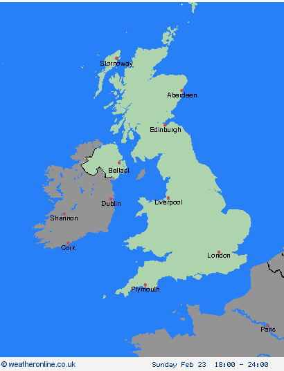
18:00-24:00


Severe Weather Warnings: Wind
issued by the Metoffice at
10:04, 20.02.2025
valid from
06:00, 23.02.2025
until
18:00, 23.02.2025
Region: Orkney & Shetland
Southerly to southwesterly winds are expected to increase through Sunday morning, peaking late morning to early afternoon with gusts of 50-60mph, and perhaps as much as 70mph in exposed spots along Irish Sea coastlines, Scottish Islands, and other areas of high ground further inland. Rain will accompany strong winds, which will make for very poor weather conditions, especially on roads. Winds will then ease from southwest to northeast of the warning area through the afternoon and early evening. What Should I Do? Give yourself the best chance of avoiding delays by checking road conditions if driving, or bus and train timetables, amending your travel plans if necessary. People cope better with power cuts when they have prepared for them in advance. It’s easy to do; consider gathering torches and batteries, a mobile phone power pack and other essential items. If you are on the coast, stay safe during stormy weather by being aware of large waves. Even from the shore large breaking waves can sweep you off your feet and out to sea. Take care if walking near cliffs; know your route and keep dogs on a lead. In an emergency, call 999 and ask for the Coastguard. Be prepared for weather warnings to change quickly: when a weather warning is issued, the Met Office recommends staying up to date with the weather forecast in your area.
Chief ForecasterStrong winds may lead to some disruption on Sunday.
The public is advised to take extra care, further information and advice can be found here: http://www.metoffice.gov.uk/weather/uk/links.html
Severe Weather Warnings: Wind
issued by the Metoffice at
10:04, 20.02.2025
valid from
06:00, 23.02.2025
until
18:00, 23.02.2025
Region: Highland & Eilean Siar
Southerly to southwesterly winds are expected to increase through Sunday morning, peaking late morning to early afternoon with gusts of 50-60mph, and perhaps as much as 70mph in exposed spots along Irish Sea coastlines, Scottish Islands, and other areas of high ground further inland. Rain will accompany strong winds, which will make for very poor weather conditions, especially on roads. Winds will then ease from southwest to northeast of the warning area through the afternoon and early evening. What Should I Do? Give yourself the best chance of avoiding delays by checking road conditions if driving, or bus and train timetables, amending your travel plans if necessary. People cope better with power cuts when they have prepared for them in advance. It’s easy to do; consider gathering torches and batteries, a mobile phone power pack and other essential items. If you are on the coast, stay safe during stormy weather by being aware of large waves. Even from the shore large breaking waves can sweep you off your feet and out to sea. Take care if walking near cliffs; know your route and keep dogs on a lead. In an emergency, call 999 and ask for the Coastguard. Be prepared for weather warnings to change quickly: when a weather warning is issued, the Met Office recommends staying up to date with the weather forecast in your area.
Chief ForecasterStrong winds may lead to some disruption on Sunday.
The public is advised to take extra care, further information and advice can be found here: http://www.metoffice.gov.uk/weather/uk/links.html
Severe Weather Warnings: Wind
issued by the Metoffice at
10:04, 20.02.2025
valid from
06:00, 23.02.2025
until
18:00, 23.02.2025
Region: Grampian
Southerly to southwesterly winds are expected to increase through Sunday morning, peaking late morning to early afternoon with gusts of 50-60mph, and perhaps as much as 70mph in exposed spots along Irish Sea coastlines, Scottish Islands, and other areas of high ground further inland. Rain will accompany strong winds, which will make for very poor weather conditions, especially on roads. Winds will then ease from southwest to northeast of the warning area through the afternoon and early evening. What Should I Do? Give yourself the best chance of avoiding delays by checking road conditions if driving, or bus and train timetables, amending your travel plans if necessary. People cope better with power cuts when they have prepared for them in advance. It’s easy to do; consider gathering torches and batteries, a mobile phone power pack and other essential items. If you are on the coast, stay safe during stormy weather by being aware of large waves. Even from the shore large breaking waves can sweep you off your feet and out to sea. Take care if walking near cliffs; know your route and keep dogs on a lead. In an emergency, call 999 and ask for the Coastguard. Be prepared for weather warnings to change quickly: when a weather warning is issued, the Met Office recommends staying up to date with the weather forecast in your area.
Chief ForecasterStrong winds may lead to some disruption on Sunday.
The public is advised to take extra care, further information and advice can be found here: http://www.metoffice.gov.uk/weather/uk/links.html
Severe Weather Warnings: Wind
issued by the Metoffice at
10:04, 20.02.2025
valid from
06:00, 23.02.2025
until
18:00, 23.02.2025
Region: Strathclyde
Southerly to southwesterly winds are expected to increase through Sunday morning, peaking late morning to early afternoon with gusts of 50-60mph, and perhaps as much as 70mph in exposed spots along Irish Sea coastlines, Scottish Islands, and other areas of high ground further inland. Rain will accompany strong winds, which will make for very poor weather conditions, especially on roads. Winds will then ease from southwest to northeast of the warning area through the afternoon and early evening. What Should I Do? Give yourself the best chance of avoiding delays by checking road conditions if driving, or bus and train timetables, amending your travel plans if necessary. People cope better with power cuts when they have prepared for them in advance. It’s easy to do; consider gathering torches and batteries, a mobile phone power pack and other essential items. If you are on the coast, stay safe during stormy weather by being aware of large waves. Even from the shore large breaking waves can sweep you off your feet and out to sea. Take care if walking near cliffs; know your route and keep dogs on a lead. In an emergency, call 999 and ask for the Coastguard. Be prepared for weather warnings to change quickly: when a weather warning is issued, the Met Office recommends staying up to date with the weather forecast in your area.
Chief ForecasterStrong winds may lead to some disruption on Sunday.
The public is advised to take extra care, further information and advice can be found here: http://www.metoffice.gov.uk/weather/uk/links.html
Severe Weather Warnings: Wind
issued by the Metoffice at
10:04, 20.02.2025
valid from
06:00, 23.02.2025
until
18:00, 23.02.2025
Region: Central, Tayside & Fife
Southerly to southwesterly winds are expected to increase through Sunday morning, peaking late morning to early afternoon with gusts of 50-60mph, and perhaps as much as 70mph in exposed spots along Irish Sea coastlines, Scottish Islands, and other areas of high ground further inland. Rain will accompany strong winds, which will make for very poor weather conditions, especially on roads. Winds will then ease from southwest to northeast of the warning area through the afternoon and early evening. What Should I Do? Give yourself the best chance of avoiding delays by checking road conditions if driving, or bus and train timetables, amending your travel plans if necessary. People cope better with power cuts when they have prepared for them in advance. It’s easy to do; consider gathering torches and batteries, a mobile phone power pack and other essential items. If you are on the coast, stay safe during stormy weather by being aware of large waves. Even from the shore large breaking waves can sweep you off your feet and out to sea. Take care if walking near cliffs; know your route and keep dogs on a lead. In an emergency, call 999 and ask for the Coastguard. Be prepared for weather warnings to change quickly: when a weather warning is issued, the Met Office recommends staying up to date with the weather forecast in your area.
Chief ForecasterStrong winds may lead to some disruption on Sunday.
The public is advised to take extra care, further information and advice can be found here: http://www.metoffice.gov.uk/weather/uk/links.html
Severe Weather Warnings: Wind
issued by the Metoffice at
10:04, 20.02.2025
valid from
06:00, 23.02.2025
until
18:00, 23.02.2025
Region: SW Scotland, Lothian Borders
Southerly to southwesterly winds are expected to increase through Sunday morning, peaking late morning to early afternoon with gusts of 50-60mph, and perhaps as much as 70mph in exposed spots along Irish Sea coastlines, Scottish Islands, and other areas of high ground further inland. Rain will accompany strong winds, which will make for very poor weather conditions, especially on roads. Winds will then ease from southwest to northeast of the warning area through the afternoon and early evening. What Should I Do? Give yourself the best chance of avoiding delays by checking road conditions if driving, or bus and train timetables, amending your travel plans if necessary. People cope better with power cuts when they have prepared for them in advance. It’s easy to do; consider gathering torches and batteries, a mobile phone power pack and other essential items. If you are on the coast, stay safe during stormy weather by being aware of large waves. Even from the shore large breaking waves can sweep you off your feet and out to sea. Take care if walking near cliffs; know your route and keep dogs on a lead. In an emergency, call 999 and ask for the Coastguard. Be prepared for weather warnings to change quickly: when a weather warning is issued, the Met Office recommends staying up to date with the weather forecast in your area.
Chief ForecasterStrong winds may lead to some disruption on Sunday.
The public is advised to take extra care, further information and advice can be found here: http://www.metoffice.gov.uk/weather/uk/links.html
Severe Weather Warnings: Wind
issued by the Metoffice at
10:04, 20.02.2025
valid from
06:00, 23.02.2025
until
18:00, 23.02.2025
Region: Wales
Southerly to southwesterly winds are expected to increase through Sunday morning, peaking late morning to early afternoon with gusts of 50-60mph, and perhaps as much as 70mph in exposed spots along Irish Sea coastlines, Scottish Islands, and other areas of high ground further inland. Rain will accompany strong winds, which will make for very poor weather conditions, especially on roads. Winds will then ease from southwest to northeast of the warning area through the afternoon and early evening. What Should I Do? Give yourself the best chance of avoiding delays by checking road conditions if driving, or bus and train timetables, amending your travel plans if necessary. People cope better with power cuts when they have prepared for them in advance. It’s easy to do; consider gathering torches and batteries, a mobile phone power pack and other essential items. If you are on the coast, stay safe during stormy weather by being aware of large waves. Even from the shore large breaking waves can sweep you off your feet and out to sea. Take care if walking near cliffs; know your route and keep dogs on a lead. In an emergency, call 999 and ask for the Coastguard. Be prepared for weather warnings to change quickly: when a weather warning is issued, the Met Office recommends staying up to date with the weather forecast in your area.
Chief ForecasterStrong winds may lead to some disruption on Sunday.
The public is advised to take extra care, further information and advice can be found here: http://www.metoffice.gov.uk/weather/uk/links.html
Severe Weather Warnings: Wind
issued by the Metoffice at
10:04, 20.02.2025
valid from
06:00, 23.02.2025
until
18:00, 23.02.2025
Region: North West England
Southerly to southwesterly winds are expected to increase through Sunday morning, peaking late morning to early afternoon with gusts of 50-60mph, and perhaps as much as 70mph in exposed spots along Irish Sea coastlines, Scottish Islands, and other areas of high ground further inland. Rain will accompany strong winds, which will make for very poor weather conditions, especially on roads. Winds will then ease from southwest to northeast of the warning area through the afternoon and early evening. What Should I Do? Give yourself the best chance of avoiding delays by checking road conditions if driving, or bus and train timetables, amending your travel plans if necessary. People cope better with power cuts when they have prepared for them in advance. It’s easy to do; consider gathering torches and batteries, a mobile phone power pack and other essential items. If you are on the coast, stay safe during stormy weather by being aware of large waves. Even from the shore large breaking waves can sweep you off your feet and out to sea. Take care if walking near cliffs; know your route and keep dogs on a lead. In an emergency, call 999 and ask for the Coastguard. Be prepared for weather warnings to change quickly: when a weather warning is issued, the Met Office recommends staying up to date with the weather forecast in your area.
Chief ForecasterStrong winds may lead to some disruption on Sunday.
The public is advised to take extra care, further information and advice can be found here: http://www.metoffice.gov.uk/weather/uk/links.html
Severe Weather Warnings: Wind
issued by the Metoffice at
10:04, 20.02.2025
valid from
06:00, 23.02.2025
until
18:00, 23.02.2025
Region: North East England
Southerly to southwesterly winds are expected to increase through Sunday morning, peaking late morning to early afternoon with gusts of 50-60mph, and perhaps as much as 70mph in exposed spots along Irish Sea coastlines, Scottish Islands, and other areas of high ground further inland. Rain will accompany strong winds, which will make for very poor weather conditions, especially on roads. Winds will then ease from southwest to northeast of the warning area through the afternoon and early evening. What Should I Do? Give yourself the best chance of avoiding delays by checking road conditions if driving, or bus and train timetables, amending your travel plans if necessary. People cope better with power cuts when they have prepared for them in advance. It’s easy to do; consider gathering torches and batteries, a mobile phone power pack and other essential items. If you are on the coast, stay safe during stormy weather by being aware of large waves. Even from the shore large breaking waves can sweep you off your feet and out to sea. Take care if walking near cliffs; know your route and keep dogs on a lead. In an emergency, call 999 and ask for the Coastguard. Be prepared for weather warnings to change quickly: when a weather warning is issued, the Met Office recommends staying up to date with the weather forecast in your area.
Chief ForecasterStrong winds may lead to some disruption on Sunday.
The public is advised to take extra care, further information and advice can be found here: http://www.metoffice.gov.uk/weather/uk/links.html
Severe Weather Warnings: Wind
issued by the Metoffice at
10:04, 20.02.2025
valid from
06:00, 23.02.2025
until
18:00, 23.02.2025
Region: Yorkshire & Humber
Southerly to southwesterly winds are expected to increase through Sunday morning, peaking late morning to early afternoon with gusts of 50-60mph, and perhaps as much as 70mph in exposed spots along Irish Sea coastlines, Scottish Islands, and other areas of high ground further inland. Rain will accompany strong winds, which will make for very poor weather conditions, especially on roads. Winds will then ease from southwest to northeast of the warning area through the afternoon and early evening. What Should I Do? Give yourself the best chance of avoiding delays by checking road conditions if driving, or bus and train timetables, amending your travel plans if necessary. People cope better with power cuts when they have prepared for them in advance. It’s easy to do; consider gathering torches and batteries, a mobile phone power pack and other essential items. If you are on the coast, stay safe during stormy weather by being aware of large waves. Even from the shore large breaking waves can sweep you off your feet and out to sea. Take care if walking near cliffs; know your route and keep dogs on a lead. In an emergency, call 999 and ask for the Coastguard. Be prepared for weather warnings to change quickly: when a weather warning is issued, the Met Office recommends staying up to date with the weather forecast in your area.
Chief ForecasterStrong winds may lead to some disruption on Sunday.
The public is advised to take extra care, further information and advice can be found here: http://www.metoffice.gov.uk/weather/uk/links.html
Severe Weather Warnings: Wind
issued by the Metoffice at
10:04, 20.02.2025
valid from
06:00, 23.02.2025
until
18:00, 23.02.2025
Region: West Midlands
Southerly to southwesterly winds are expected to increase through Sunday morning, peaking late morning to early afternoon with gusts of 50-60mph, and perhaps as much as 70mph in exposed spots along Irish Sea coastlines, Scottish Islands, and other areas of high ground further inland. Rain will accompany strong winds, which will make for very poor weather conditions, especially on roads. Winds will then ease from southwest to northeast of the warning area through the afternoon and early evening. What Should I Do? Give yourself the best chance of avoiding delays by checking road conditions if driving, or bus and train timetables, amending your travel plans if necessary. People cope better with power cuts when they have prepared for them in advance. It’s easy to do; consider gathering torches and batteries, a mobile phone power pack and other essential items. If you are on the coast, stay safe during stormy weather by being aware of large waves. Even from the shore large breaking waves can sweep you off your feet and out to sea. Take care if walking near cliffs; know your route and keep dogs on a lead. In an emergency, call 999 and ask for the Coastguard. Be prepared for weather warnings to change quickly: when a weather warning is issued, the Met Office recommends staying up to date with the weather forecast in your area.
Chief ForecasterStrong winds may lead to some disruption on Sunday.
The public is advised to take extra care, further information and advice can be found here: http://www.metoffice.gov.uk/weather/uk/links.html
Severe Weather Warnings: Wind
issued by the Metoffice at
10:04, 20.02.2025
valid from
06:00, 23.02.2025
until
18:00, 23.02.2025
Region: East Midlands
Southerly to southwesterly winds are expected to increase through Sunday morning, peaking late morning to early afternoon with gusts of 50-60mph, and perhaps as much as 70mph in exposed spots along Irish Sea coastlines, Scottish Islands, and other areas of high ground further inland. Rain will accompany strong winds, which will make for very poor weather conditions, especially on roads. Winds will then ease from southwest to northeast of the warning area through the afternoon and early evening. What Should I Do? Give yourself the best chance of avoiding delays by checking road conditions if driving, or bus and train timetables, amending your travel plans if necessary. People cope better with power cuts when they have prepared for them in advance. It’s easy to do; consider gathering torches and batteries, a mobile phone power pack and other essential items. If you are on the coast, stay safe during stormy weather by being aware of large waves. Even from the shore large breaking waves can sweep you off your feet and out to sea. Take care if walking near cliffs; know your route and keep dogs on a lead. In an emergency, call 999 and ask for the Coastguard. Be prepared for weather warnings to change quickly: when a weather warning is issued, the Met Office recommends staying up to date with the weather forecast in your area.
Chief ForecasterStrong winds may lead to some disruption on Sunday.
The public is advised to take extra care, further information and advice can be found here: http://www.metoffice.gov.uk/weather/uk/links.html
Severe Weather Warnings: Wind
issued by the Metoffice at
10:04, 20.02.2025
valid from
06:00, 23.02.2025
until
18:00, 23.02.2025
Region: South West England
Southerly to southwesterly winds are expected to increase through Sunday morning, peaking late morning to early afternoon with gusts of 50-60mph, and perhaps as much as 70mph in exposed spots along Irish Sea coastlines, Scottish Islands, and other areas of high ground further inland. Rain will accompany strong winds, which will make for very poor weather conditions, especially on roads. Winds will then ease from southwest to northeast of the warning area through the afternoon and early evening. What Should I Do? Give yourself the best chance of avoiding delays by checking road conditions if driving, or bus and train timetables, amending your travel plans if necessary. People cope better with power cuts when they have prepared for them in advance. It’s easy to do; consider gathering torches and batteries, a mobile phone power pack and other essential items. If you are on the coast, stay safe during stormy weather by being aware of large waves. Even from the shore large breaking waves can sweep you off your feet and out to sea. Take care if walking near cliffs; know your route and keep dogs on a lead. In an emergency, call 999 and ask for the Coastguard. Be prepared for weather warnings to change quickly: when a weather warning is issued, the Met Office recommends staying up to date with the weather forecast in your area.
Chief ForecasterStrong winds may lead to some disruption on Sunday.
The public is advised to take extra care, further information and advice can be found here: http://www.metoffice.gov.uk/weather/uk/links.html


20.02.2025