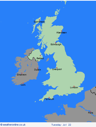
Weather Warnings Archive: Sunday 20 Jul 2025 22:00 BST - UK


00:00-06:00

06:00-12:00

12:00-18:00

18:00-24:00


Severe Weather Warnings: Thunderstorms
issued by the Metoffice at
21:00, 20.07.2025
valid from
12:00, 20.07.2025
until
22:00, 20.07.2025
Region: Highland & Eilean Siar
Scattered heavy showers and thunderstorms are expected during Sunday afternoon and early evening. Rainfall amounts will vary from place to place but in some locations 20-40 mm is possible within a couple of hours. Heavy downpours of rain will be the primary hazard, but lightning strikes and hail are also likely. What Should I Do? Consider if your location is at risk of flash flooding. If so, consider preparing a flood plan and an emergency flood kit. Prepare to protect your property and people from injury. Before gusty winds arrive, check to ensure moveable objects or temporary structures are well secured. Items include; bins, garden furniture, trampolines, tents, gazebos, sheds, and fences. Give yourself the best chance of avoiding delays by checking road conditions if driving, or bus and train timetables, amending your travel plans if necessary. People cope better with power cuts when they have prepared for them in advance. It’s easy to do; consider gathering torches and batteries, a mobile phone power pack and other essential items. If you find yourself outside and hear thunder, protect yourself by finding a safe enclosed shelter (such as a car). Do not shelter under or near trees, or other structures which may be struck by lightning. If you are on an elevated area move to lower ground. Be prepared for weather warnings to change quickly: when a weather warning is issued, the Met Office recommends staying up to date with the weather forecast in your area.
Chief ForecasterHeavy showers and thunderstorms may lead to flooding and disruption in a few places.
The public is advised to take extra care, further information and advice can be found here: http://www.metoffice.gov.uk/weather/uk/links.html
Severe Weather Warnings: Rain
issued by the Metoffice at
21:00, 20.07.2025
valid from
12:00, 19.07.2025
until
12:00, 20.07.2025
Region: Highland & Eilean Siar
Areas of heavy rain with isolated thunderstorms are expected to arrive from the south during Saturday afternoon, becoming persistent in places and leading to some large totals building up, particularly on southeast facing areas of high ground. Many places are likely to see 20-30 mm, but some locations could see 50-75 mm in just a few hours. What Should I Do? Check if your property could be at risk of flooding. If so, consider preparing a flood plan and an emergency flood kit. Give yourself the best chance of avoiding delays by checking road conditions if driving, or bus and train timetables, amending your travel plans if necessary. People cope better with power cuts when they have prepared for them in advance. It’s easy to do; consider gathering torches and batteries, a mobile phone power pack and other essential items. Be prepared for weather warnings to change quickly: when a weather warning is issued, the Met Office recommends staying up to date with the weather forecast in your area.
Chief ForecasterHeavy rain and isolated thunderstorms may cause some flooding during Saturday afternoon and evening, overnight into Sunday.
The public is advised to take extra care, further information and advice can be found here: http://www.metoffice.gov.uk/weather/uk/links.html
Severe Weather Warnings: Rain
issued by the Metoffice at
21:00, 20.07.2025
valid from
12:00, 19.07.2025
until
12:00, 20.07.2025
Region: Grampian
Areas of heavy rain with isolated thunderstorms are expected to arrive from the south during Saturday afternoon, becoming persistent in places and leading to some large totals building up, particularly on southeast facing areas of high ground. Many places are likely to see 20-30 mm, but some locations could see 50-75 mm in just a few hours. What Should I Do? Check if your property could be at risk of flooding. If so, consider preparing a flood plan and an emergency flood kit. Give yourself the best chance of avoiding delays by checking road conditions if driving, or bus and train timetables, amending your travel plans if necessary. People cope better with power cuts when they have prepared for them in advance. It’s easy to do; consider gathering torches and batteries, a mobile phone power pack and other essential items. Be prepared for weather warnings to change quickly: when a weather warning is issued, the Met Office recommends staying up to date with the weather forecast in your area.
Chief ForecasterHeavy rain and isolated thunderstorms may cause some flooding during Saturday afternoon and evening, overnight into Sunday.
The public is advised to take extra care, further information and advice can be found here: http://www.metoffice.gov.uk/weather/uk/links.html
Severe Weather Warnings: Thunderstorms
issued by the Metoffice at
21:00, 20.07.2025
valid from
12:00, 20.07.2025
until
22:00, 20.07.2025
Region: Strathclyde
Scattered heavy showers and thunderstorms are expected during Sunday afternoon and early evening. Rainfall amounts will vary from place to place but in some locations 20-40 mm is possible within a couple of hours. Heavy downpours of rain will be the primary hazard, but lightning strikes and hail are also likely. What Should I Do? Consider if your location is at risk of flash flooding. If so, consider preparing a flood plan and an emergency flood kit. Prepare to protect your property and people from injury. Before gusty winds arrive, check to ensure moveable objects or temporary structures are well secured. Items include; bins, garden furniture, trampolines, tents, gazebos, sheds, and fences. Give yourself the best chance of avoiding delays by checking road conditions if driving, or bus and train timetables, amending your travel plans if necessary. People cope better with power cuts when they have prepared for them in advance. It’s easy to do; consider gathering torches and batteries, a mobile phone power pack and other essential items. If you find yourself outside and hear thunder, protect yourself by finding a safe enclosed shelter (such as a car). Do not shelter under or near trees, or other structures which may be struck by lightning. If you are on an elevated area move to lower ground. Be prepared for weather warnings to change quickly: when a weather warning is issued, the Met Office recommends staying up to date with the weather forecast in your area.
Chief ForecasterHeavy showers and thunderstorms may lead to flooding and disruption in a few places.
The public is advised to take extra care, further information and advice can be found here: http://www.metoffice.gov.uk/weather/uk/links.html
Severe Weather Warnings: Rain
issued by the Metoffice at
21:00, 20.07.2025
valid from
12:00, 19.07.2025
until
12:00, 20.07.2025
Region: Strathclyde
Areas of heavy rain with isolated thunderstorms are expected to arrive from the south during Saturday afternoon, becoming persistent in places and leading to some large totals building up, particularly on southeast facing areas of high ground. Many places are likely to see 20-30 mm, but some locations could see 50-75 mm in just a few hours. What Should I Do? Check if your property could be at risk of flooding. If so, consider preparing a flood plan and an emergency flood kit. Give yourself the best chance of avoiding delays by checking road conditions if driving, or bus and train timetables, amending your travel plans if necessary. People cope better with power cuts when they have prepared for them in advance. It’s easy to do; consider gathering torches and batteries, a mobile phone power pack and other essential items. Be prepared for weather warnings to change quickly: when a weather warning is issued, the Met Office recommends staying up to date with the weather forecast in your area.
Chief ForecasterHeavy rain and isolated thunderstorms may cause some flooding during Saturday afternoon and evening, overnight into Sunday.
The public is advised to take extra care, further information and advice can be found here: http://www.metoffice.gov.uk/weather/uk/links.html
Severe Weather Warnings: Thunderstorms
issued by the Metoffice at
21:00, 20.07.2025
valid from
12:00, 20.07.2025
until
22:00, 20.07.2025
Region: Central, Tayside & Fife
Scattered heavy showers and thunderstorms are expected during Sunday afternoon and early evening. Rainfall amounts will vary from place to place but in some locations 20-40 mm is possible within a couple of hours. Heavy downpours of rain will be the primary hazard, but lightning strikes and hail are also likely. What Should I Do? Consider if your location is at risk of flash flooding. If so, consider preparing a flood plan and an emergency flood kit. Prepare to protect your property and people from injury. Before gusty winds arrive, check to ensure moveable objects or temporary structures are well secured. Items include; bins, garden furniture, trampolines, tents, gazebos, sheds, and fences. Give yourself the best chance of avoiding delays by checking road conditions if driving, or bus and train timetables, amending your travel plans if necessary. People cope better with power cuts when they have prepared for them in advance. It’s easy to do; consider gathering torches and batteries, a mobile phone power pack and other essential items. If you find yourself outside and hear thunder, protect yourself by finding a safe enclosed shelter (such as a car). Do not shelter under or near trees, or other structures which may be struck by lightning. If you are on an elevated area move to lower ground. Be prepared for weather warnings to change quickly: when a weather warning is issued, the Met Office recommends staying up to date with the weather forecast in your area.
Chief ForecasterHeavy showers and thunderstorms may lead to flooding and disruption in a few places.
The public is advised to take extra care, further information and advice can be found here: http://www.metoffice.gov.uk/weather/uk/links.html
Severe Weather Warnings: Rain
issued by the Metoffice at
21:00, 20.07.2025
valid from
12:00, 19.07.2025
until
12:00, 20.07.2025
Region: Central, Tayside & Fife
Areas of heavy rain with isolated thunderstorms are expected to arrive from the south during Saturday afternoon, becoming persistent in places and leading to some large totals building up, particularly on southeast facing areas of high ground. Many places are likely to see 20-30 mm, but some locations could see 50-75 mm in just a few hours. What Should I Do? Check if your property could be at risk of flooding. If so, consider preparing a flood plan and an emergency flood kit. Give yourself the best chance of avoiding delays by checking road conditions if driving, or bus and train timetables, amending your travel plans if necessary. People cope better with power cuts when they have prepared for them in advance. It’s easy to do; consider gathering torches and batteries, a mobile phone power pack and other essential items. Be prepared for weather warnings to change quickly: when a weather warning is issued, the Met Office recommends staying up to date with the weather forecast in your area.
Chief ForecasterHeavy rain and isolated thunderstorms may cause some flooding during Saturday afternoon and evening, overnight into Sunday.
The public is advised to take extra care, further information and advice can be found here: http://www.metoffice.gov.uk/weather/uk/links.html
Severe Weather Warnings: Rain
issued by the Metoffice at
21:00, 20.07.2025
valid from
12:00, 19.07.2025
until
12:00, 20.07.2025
Region: SW Scotland, Lothian Borders
Areas of heavy rain with isolated thunderstorms are expected to arrive from the south during Saturday afternoon, becoming persistent in places and leading to some large totals building up, particularly on southeast facing areas of high ground. Many places are likely to see 20-30 mm, but some locations could see 50-75 mm in just a few hours. What Should I Do? Check if your property could be at risk of flooding. If so, consider preparing a flood plan and an emergency flood kit. Give yourself the best chance of avoiding delays by checking road conditions if driving, or bus and train timetables, amending your travel plans if necessary. People cope better with power cuts when they have prepared for them in advance. It’s easy to do; consider gathering torches and batteries, a mobile phone power pack and other essential items. Be prepared for weather warnings to change quickly: when a weather warning is issued, the Met Office recommends staying up to date with the weather forecast in your area.
Chief ForecasterHeavy rain and isolated thunderstorms may cause some flooding during Saturday afternoon and evening, overnight into Sunday.
The public is advised to take extra care, further information and advice can be found here: http://www.metoffice.gov.uk/weather/uk/links.html
Severe Weather Warnings: Thunderstorms
issued by the Metoffice at
21:00, 20.07.2025
valid from
12:00, 20.07.2025
until
22:00, 20.07.2025
Region: SW Scotland, Lothian Borders
Scattered heavy showers and thunderstorms are expected during Sunday afternoon and early evening. Rainfall amounts will vary from place to place but in some locations 20-40 mm is possible within a couple of hours. Heavy downpours of rain will be the primary hazard, but lightning strikes and hail are also likely. What Should I Do? Consider if your location is at risk of flash flooding. If so, consider preparing a flood plan and an emergency flood kit. Prepare to protect your property and people from injury. Before gusty winds arrive, check to ensure moveable objects or temporary structures are well secured. Items include; bins, garden furniture, trampolines, tents, gazebos, sheds, and fences. Give yourself the best chance of avoiding delays by checking road conditions if driving, or bus and train timetables, amending your travel plans if necessary. People cope better with power cuts when they have prepared for them in advance. It’s easy to do; consider gathering torches and batteries, a mobile phone power pack and other essential items. If you find yourself outside and hear thunder, protect yourself by finding a safe enclosed shelter (such as a car). Do not shelter under or near trees, or other structures which may be struck by lightning. If you are on an elevated area move to lower ground. Be prepared for weather warnings to change quickly: when a weather warning is issued, the Met Office recommends staying up to date with the weather forecast in your area.
Chief ForecasterHeavy showers and thunderstorms may lead to flooding and disruption in a few places.
The public is advised to take extra care, further information and advice can be found here: http://www.metoffice.gov.uk/weather/uk/links.html
Severe Weather Warnings: Rain
issued by the Metoffice at
21:00, 20.07.2025
valid from
23:00, 20.07.2025
until
08:00, 21.07.2025
Region: Northern Ireland
A spell of very heavy rain is expected to affect parts of east and southeast Northern Ireland during Sunday night and at first on Monday morning. There remains some uncertainty in the northern extent of the heaviest rain, but some places are likely to have 50-75 mm of rain in a short space of time with a risk of flash flooding. What Should I Do? Keep yourself and others safe; prepare to avoid travelling by road during potentially dangerous road conditions. If you must travel, ensure you watch for possible danger and drive cautiously. It is not safe to drive, walk or swim through floodwater, avoid it where possible and if you are affected by fast flowing or deep-water call 999, and wait for help. Preparing a flood kit could save you from loss or damage due to flooding to your home or business. In your flood kit have: insurance and any other important documents; a torch & spare batteries; a first aid kit, prescription medicines and supplies for looking after your family members or pets; and warm, waterproof clothes, blankets, food and water. Consider checking on vulnerable people that you know including older people, those with underlying conditions and those who live alone; they may need support with food and medical supplies. If you are worried about your health or that of somebody you know, consult NI:DIRECT. Stay up to date with the weather forecast for your area and follow advice from emergency services and local authorities.
Chief ForecasterVery heavy rainfall is expected on Sunday night leading to the potential for flooding.
The public is advised to take extra care, further information and advice can be found here: http://www.metoffice.gov.uk/weather/uk/links.html
Severe Weather Warnings: Rain
issued by the Metoffice at
21:00, 20.07.2025
valid from
18:00, 20.07.2025
until
18:00, 21.07.2025
Region: Northern Ireland
A band of rain will become heavy and persistent during Sunday night and Monday, most likely across more eastern and southeastern parts of Northern Ireland. There remains a good deal of uncertainty as to the east-west position of this rain band, but where it does occur some places could see 50-75 mm in 12-18 hours. What Should I Do? Check if your property could be at risk of flooding. If so, consider preparing a flood plan and an emergency flood kit. Give yourself the best chance of avoiding delays by checking road conditions if driving, or bus and train timetables, amending your travel plans if necessary. People cope better with power cuts when they have prepared for them in advance. It’s easy to do; consider gathering torches and batteries, a mobile phone power pack and other essential items. Be prepared for weather warnings to change quickly: when a weather warning is issued, the Met Office recommends staying up to date with the weather forecast in your area.
Chief ForecasterHeavy rain may cause some flooding and disruption during Sunday night and Monday.
The public is advised to take extra care, further information and advice can be found here: http://www.metoffice.gov.uk/weather/uk/links.html
Severe Weather Warnings: Thunderstorms
issued by the Metoffice at
21:00, 20.07.2025
valid from
12:00, 20.07.2025
until
20:00, 20.07.2025
Region: Northern Ireland
Scattered heavy showers and a few thunderstorms are expected during Sunday. Rainfall amounts will vary from place to place but in some locations 20-40 mm is possible within a couple of hours. Heavy downpours of rain will be the primary hazard, but lightning strikes and hail are also possible. What Should I Do? People cope better with power cuts when they have prepared for them in advance. It’s easy to do; consider gathering torches and batteries, a mobile phone power pack and other essential items. If you find yourself outside during a lightning event, protect yourself by finding a safe enclosed shelter (such as a car). Do not shelter under or near trees, or other structures which may be struck by lightning. If you are on an elevated area move to lower ground. Be prepared for weather warnings to change quickly: when a weather warning is issued, the Met Office recommends staying up to date with the weather forecast in your area.
Chief ForecasterHeavy showers and thunderstorms may lead to some flooding and disruption in places.
The public is advised to take extra care, further information and advice can be found here: http://www.metoffice.gov.uk/weather/uk/links.html
Severe Weather Warnings: Thunderstorms
issued by the Metoffice at
21:00, 20.07.2025
valid from
18:00, 19.07.2025
until
22:00, 20.07.2025
Region: Wales
Scattered heavy showers and thunderstorms are expected to develop during the course of Sunday. Rainfall amounts will vary from place to place but in some locations 20-40 mm is possible within a couple of hours. Heavy downpours of rain will be the primary hazard, but lightning strikes are also likely along with the potential for hail and gusty winds. What Should I Do? Consider if your location is at risk of flash flooding. If so, consider preparing a flood plan and an emergency flood kit. Prepare to protect your property and people from injury. Before gusty winds arrive, check to ensure moveable objects or temporary structures are well secured. Items include; bins, garden furniture, trampolines, tents, gazebos, sheds, and fences. Give yourself the best chance of avoiding delays by checking road conditions if driving, or bus and train timetables, amending your travel plans if necessary. People cope better with power cuts when they have prepared for them in advance. It’s easy to do; consider gathering torches and batteries, a mobile phone power pack and other essential items. If you find yourself outside and hear thunder, protect yourself by finding a safe enclosed shelter (such as a car). Do not shelter under or near trees, or other structures which may be struck by lightning. If you are on an elevated area move to lower ground. Be prepared for weather warnings to change quickly: when a weather warning is issued, the Met Office recommends staying up to date with the weather forecast in your area.
Chief ForecasterHeavy showers and scattered thunderstorms may cause some localised flooding and transport disruption.
The public is advised to take extra care, further information and advice can be found here: http://www.metoffice.gov.uk/weather/uk/links.html
Severe Weather Warnings: Rain
issued by the Metoffice at
21:00, 20.07.2025
valid from
11:00, 20.07.2025
until
22:00, 20.07.2025
Region: Wales
Showery outbreaks of rain, heavy and perhaps thundery in places, will move northwestwards from late Sunday morning and through the afternoon before gradually easing during the evening. Accumulations of 10-20 mm are expected fairly widely, with a few places potentially receiving as much as 40 mm, much of this falling in just a few hours. This could lead to some surface water flooding. What Should I Do? Check if your property could be at risk of flooding. If so, consider preparing a flood plan and an emergency flood kit. Give yourself the best chance of avoiding delays by checking road conditions if driving, or bus and train timetables, amending your travel plans if necessary. People cope better with power cuts when they have prepared for them in advance. It’s easy to do; consider gathering torches and batteries, a mobile phone power pack and other essential items. Be prepared for weather warnings to change quickly: when a weather warning is issued, the Met Office recommends staying up to date with the weather forecast in your area.
Chief ForecasterShowery rain, heavy and perhaps thundery, may cause some localised surface water flooding on Sunday
The public is advised to take extra care, further information and advice can be found here: http://www.metoffice.gov.uk/weather/uk/links.html
Severe Weather Warnings: Rain
issued by the Metoffice at
21:00, 20.07.2025
valid from
12:00, 19.07.2025
until
12:00, 20.07.2025
Region: North West England
Areas of heavy rain with isolated thunderstorms are expected to arrive from the south during Saturday afternoon, becoming persistent in places and leading to some large totals building up, particularly on southeast facing areas of high ground. Many places are likely to see 20-30 mm, but some locations could see 50-75 mm in just a few hours. What Should I Do? Check if your property could be at risk of flooding. If so, consider preparing a flood plan and an emergency flood kit. Give yourself the best chance of avoiding delays by checking road conditions if driving, or bus and train timetables, amending your travel plans if necessary. People cope better with power cuts when they have prepared for them in advance. It’s easy to do; consider gathering torches and batteries, a mobile phone power pack and other essential items. Be prepared for weather warnings to change quickly: when a weather warning is issued, the Met Office recommends staying up to date with the weather forecast in your area.
Chief ForecasterHeavy rain and isolated thunderstorms may cause some flooding during Saturday afternoon and evening, overnight into Sunday.
The public is advised to take extra care, further information and advice can be found here: http://www.metoffice.gov.uk/weather/uk/links.html
Severe Weather Warnings: Rain
issued by the Metoffice at
21:00, 20.07.2025
valid from
11:00, 20.07.2025
until
22:00, 20.07.2025
Region: North West England
Showery outbreaks of rain, heavy and perhaps thundery in places, will move northwestwards from late Sunday morning and through the afternoon before gradually easing during the evening. Accumulations of 10-20 mm are expected fairly widely, with a few places potentially receiving as much as 40 mm, much of this falling in just a few hours. This could lead to some surface water flooding. What Should I Do? Check if your property could be at risk of flooding. If so, consider preparing a flood plan and an emergency flood kit. Give yourself the best chance of avoiding delays by checking road conditions if driving, or bus and train timetables, amending your travel plans if necessary. People cope better with power cuts when they have prepared for them in advance. It’s easy to do; consider gathering torches and batteries, a mobile phone power pack and other essential items. Be prepared for weather warnings to change quickly: when a weather warning is issued, the Met Office recommends staying up to date with the weather forecast in your area.
Chief ForecasterShowery rain, heavy and perhaps thundery, may cause some localised surface water flooding on Sunday
The public is advised to take extra care, further information and advice can be found here: http://www.metoffice.gov.uk/weather/uk/links.html
Severe Weather Warnings: Rain
issued by the Metoffice at
21:00, 20.07.2025
valid from
12:00, 19.07.2025
until
12:00, 20.07.2025
Region: North East England
Areas of heavy rain with isolated thunderstorms are expected to arrive from the south during Saturday afternoon, becoming persistent in places and leading to some large totals building up, particularly on southeast facing areas of high ground. Many places are likely to see 20-30 mm, but some locations could see 50-75 mm in just a few hours. What Should I Do? Check if your property could be at risk of flooding. If so, consider preparing a flood plan and an emergency flood kit. Give yourself the best chance of avoiding delays by checking road conditions if driving, or bus and train timetables, amending your travel plans if necessary. People cope better with power cuts when they have prepared for them in advance. It’s easy to do; consider gathering torches and batteries, a mobile phone power pack and other essential items. Be prepared for weather warnings to change quickly: when a weather warning is issued, the Met Office recommends staying up to date with the weather forecast in your area.
Chief ForecasterHeavy rain and isolated thunderstorms may cause some flooding during Saturday afternoon and evening, overnight into Sunday.
The public is advised to take extra care, further information and advice can be found here: http://www.metoffice.gov.uk/weather/uk/links.html
Severe Weather Warnings: Rain
issued by the Metoffice at
21:00, 20.07.2025
valid from
11:00, 20.07.2025
until
22:00, 20.07.2025
Region: North East England
Showery outbreaks of rain, heavy and perhaps thundery in places, will move northwestwards from late Sunday morning and through the afternoon before gradually easing during the evening. Accumulations of 10-20 mm are expected fairly widely, with a few places potentially receiving as much as 40 mm, much of this falling in just a few hours. This could lead to some surface water flooding. What Should I Do? Check if your property could be at risk of flooding. If so, consider preparing a flood plan and an emergency flood kit. Give yourself the best chance of avoiding delays by checking road conditions if driving, or bus and train timetables, amending your travel plans if necessary. People cope better with power cuts when they have prepared for them in advance. It’s easy to do; consider gathering torches and batteries, a mobile phone power pack and other essential items. Be prepared for weather warnings to change quickly: when a weather warning is issued, the Met Office recommends staying up to date with the weather forecast in your area.
Chief ForecasterShowery rain, heavy and perhaps thundery, may cause some localised surface water flooding on Sunday
The public is advised to take extra care, further information and advice can be found here: http://www.metoffice.gov.uk/weather/uk/links.html
Severe Weather Warnings: Rain
issued by the Metoffice at
21:00, 20.07.2025
valid from
11:00, 20.07.2025
until
22:00, 20.07.2025
Region: Yorkshire & Humber
Showery outbreaks of rain, heavy and perhaps thundery in places, will move northwestwards from late Sunday morning and through the afternoon before gradually easing during the evening. Accumulations of 10-20 mm are expected fairly widely, with a few places potentially receiving as much as 40 mm, much of this falling in just a few hours. This could lead to some surface water flooding. What Should I Do? Check if your property could be at risk of flooding. If so, consider preparing a flood plan and an emergency flood kit. Give yourself the best chance of avoiding delays by checking road conditions if driving, or bus and train timetables, amending your travel plans if necessary. People cope better with power cuts when they have prepared for them in advance. It’s easy to do; consider gathering torches and batteries, a mobile phone power pack and other essential items. Be prepared for weather warnings to change quickly: when a weather warning is issued, the Met Office recommends staying up to date with the weather forecast in your area.
Chief ForecasterShowery rain, heavy and perhaps thundery, may cause some localised surface water flooding on Sunday
The public is advised to take extra care, further information and advice can be found here: http://www.metoffice.gov.uk/weather/uk/links.html
Severe Weather Warnings: Thunderstorms
issued by the Metoffice at
21:00, 20.07.2025
valid from
18:00, 19.07.2025
until
22:00, 20.07.2025
Region: West Midlands
Scattered heavy showers and thunderstorms are expected to develop during the course of Sunday. Rainfall amounts will vary from place to place but in some locations 20-40 mm is possible within a couple of hours. Heavy downpours of rain will be the primary hazard, but lightning strikes are also likely along with the potential for hail and gusty winds. What Should I Do? Consider if your location is at risk of flash flooding. If so, consider preparing a flood plan and an emergency flood kit. Prepare to protect your property and people from injury. Before gusty winds arrive, check to ensure moveable objects or temporary structures are well secured. Items include; bins, garden furniture, trampolines, tents, gazebos, sheds, and fences. Give yourself the best chance of avoiding delays by checking road conditions if driving, or bus and train timetables, amending your travel plans if necessary. People cope better with power cuts when they have prepared for them in advance. It’s easy to do; consider gathering torches and batteries, a mobile phone power pack and other essential items. If you find yourself outside and hear thunder, protect yourself by finding a safe enclosed shelter (such as a car). Do not shelter under or near trees, or other structures which may be struck by lightning. If you are on an elevated area move to lower ground. Be prepared for weather warnings to change quickly: when a weather warning is issued, the Met Office recommends staying up to date with the weather forecast in your area.
Chief ForecasterHeavy showers and scattered thunderstorms may cause some localised flooding and transport disruption.
The public is advised to take extra care, further information and advice can be found here: http://www.metoffice.gov.uk/weather/uk/links.html
Severe Weather Warnings: Rain
issued by the Metoffice at
21:00, 20.07.2025
valid from
11:00, 20.07.2025
until
22:00, 20.07.2025
Region: West Midlands
Showery outbreaks of rain, heavy and perhaps thundery in places, will move northwestwards from late Sunday morning and through the afternoon before gradually easing during the evening. Accumulations of 10-20 mm are expected fairly widely, with a few places potentially receiving as much as 40 mm, much of this falling in just a few hours. This could lead to some surface water flooding. What Should I Do? Check if your property could be at risk of flooding. If so, consider preparing a flood plan and an emergency flood kit. Give yourself the best chance of avoiding delays by checking road conditions if driving, or bus and train timetables, amending your travel plans if necessary. People cope better with power cuts when they have prepared for them in advance. It’s easy to do; consider gathering torches and batteries, a mobile phone power pack and other essential items. Be prepared for weather warnings to change quickly: when a weather warning is issued, the Met Office recommends staying up to date with the weather forecast in your area.
Chief ForecasterShowery rain, heavy and perhaps thundery, may cause some localised surface water flooding on Sunday
The public is advised to take extra care, further information and advice can be found here: http://www.metoffice.gov.uk/weather/uk/links.html
Severe Weather Warnings: Rain
issued by the Metoffice at
21:00, 20.07.2025
valid from
11:00, 20.07.2025
until
22:00, 20.07.2025
Region: East Midlands
Showery outbreaks of rain, heavy and perhaps thundery in places, will move northwestwards from late Sunday morning and through the afternoon before gradually easing during the evening. Accumulations of 10-20 mm are expected fairly widely, with a few places potentially receiving as much as 40 mm, much of this falling in just a few hours. This could lead to some surface water flooding. What Should I Do? Check if your property could be at risk of flooding. If so, consider preparing a flood plan and an emergency flood kit. Give yourself the best chance of avoiding delays by checking road conditions if driving, or bus and train timetables, amending your travel plans if necessary. People cope better with power cuts when they have prepared for them in advance. It’s easy to do; consider gathering torches and batteries, a mobile phone power pack and other essential items. Be prepared for weather warnings to change quickly: when a weather warning is issued, the Met Office recommends staying up to date with the weather forecast in your area.
Chief ForecasterShowery rain, heavy and perhaps thundery, may cause some localised surface water flooding on Sunday
The public is advised to take extra care, further information and advice can be found here: http://www.metoffice.gov.uk/weather/uk/links.html
Severe Weather Warnings: Thunderstorms
issued by the Metoffice at
21:00, 20.07.2025
valid from
18:00, 19.07.2025
until
22:00, 20.07.2025
Region: South West England
Scattered heavy showers and thunderstorms are expected to develop during the course of Sunday. Rainfall amounts will vary from place to place but in some locations 20-40 mm is possible within a couple of hours. Heavy downpours of rain will be the primary hazard, but lightning strikes are also likely along with the potential for hail and gusty winds. What Should I Do? Consider if your location is at risk of flash flooding. If so, consider preparing a flood plan and an emergency flood kit. Prepare to protect your property and people from injury. Before gusty winds arrive, check to ensure moveable objects or temporary structures are well secured. Items include; bins, garden furniture, trampolines, tents, gazebos, sheds, and fences. Give yourself the best chance of avoiding delays by checking road conditions if driving, or bus and train timetables, amending your travel plans if necessary. People cope better with power cuts when they have prepared for them in advance. It’s easy to do; consider gathering torches and batteries, a mobile phone power pack and other essential items. If you find yourself outside and hear thunder, protect yourself by finding a safe enclosed shelter (such as a car). Do not shelter under or near trees, or other structures which may be struck by lightning. If you are on an elevated area move to lower ground. Be prepared for weather warnings to change quickly: when a weather warning is issued, the Met Office recommends staying up to date with the weather forecast in your area.
Chief ForecasterHeavy showers and scattered thunderstorms may cause some localised flooding and transport disruption.
The public is advised to take extra care, further information and advice can be found here: http://www.metoffice.gov.uk/weather/uk/links.html


20.07.2025