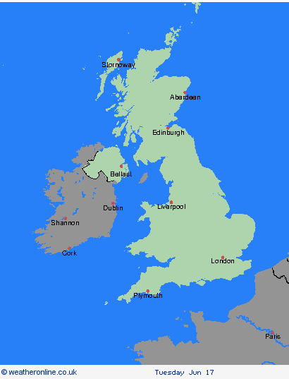
Weather Warnings Archive: Saturday 14 Jun 2025 00:00 BST - UK


00:00-06:00

06:00-12:00

12:00-18:00

18:00-24:00


Severe Weather Warnings: Thunderstorms
issued by the Metoffice at
23:00, 13.06.2025
valid from
00:00, 14.06.2025
until
18:00, 14.06.2025
Region: Highland & Eilean Siar
Areas of heavy rain and some thunderstorms will develop over Wales, western and northern England and Scotland on Saturday. This area will gradually move northwards during the day with southern parts of the warning area improving though then with a risk of isolated smaller scale thunderstorms forming. Rainfall will vary across the warning area and some places will avoid the heaviest rain. However a corridor of 15-30 mm of rain is likely with some areas perhaps seeing 30-50 mm falling in a few hours. Event rainfall could reach 60-80 mm in some locations. Strong gusts and hail may also accompany some of the thunderstorms. What Should I Do? Consider if your location is at risk of flash flooding. If so, consider preparing a flood plan and an emergency flood kit. Prepare to protect your property and people from injury. Before gusty winds arrive, check to ensure moveable objects or temporary structures are well secured. Items include; bins, garden furniture, trampolines, tents, gazebos, sheds, and fences. Give yourself the best chance of avoiding delays by checking road conditions if driving, or bus and train timetables, amending your travel plans if necessary. People cope better with power cuts when they have prepared for them in advance. It’s easy to do; consider gathering torches and batteries, a mobile phone power pack and other essential items. If you find yourself outside and hear thunder, protect yourself by finding a safe enclosed shelter (such as a car). Do not shelter under or near trees, or other structures which may be struck by lightning. If you are on an elevated area move to lower ground. Be prepared for weather warnings to change quickly: when a weather warning is issued, the Met Office recommends staying up to date with the weather forecast in your area.
Chief ForecasterHeavy rain and thunderstorms may lead to some disruption.
The public is advised to take extra care, further information and advice can be found here: http://www.metoffice.gov.uk/weather/uk/links.html
Severe Weather Warnings: Thunderstorms
issued by the Metoffice at
23:00, 13.06.2025
valid from
00:00, 14.06.2025
until
18:00, 14.06.2025
Region: Grampian
Areas of heavy rain and some thunderstorms will develop over Wales, western and northern England and Scotland on Saturday. This area will gradually move northwards during the day with southern parts of the warning area improving though then with a risk of isolated smaller scale thunderstorms forming. Rainfall will vary across the warning area and some places will avoid the heaviest rain. However a corridor of 15-30 mm of rain is likely with some areas perhaps seeing 30-50 mm falling in a few hours. Event rainfall could reach 60-80 mm in some locations. Strong gusts and hail may also accompany some of the thunderstorms. What Should I Do? Consider if your location is at risk of flash flooding. If so, consider preparing a flood plan and an emergency flood kit. Prepare to protect your property and people from injury. Before gusty winds arrive, check to ensure moveable objects or temporary structures are well secured. Items include; bins, garden furniture, trampolines, tents, gazebos, sheds, and fences. Give yourself the best chance of avoiding delays by checking road conditions if driving, or bus and train timetables, amending your travel plans if necessary. People cope better with power cuts when they have prepared for them in advance. It’s easy to do; consider gathering torches and batteries, a mobile phone power pack and other essential items. If you find yourself outside and hear thunder, protect yourself by finding a safe enclosed shelter (such as a car). Do not shelter under or near trees, or other structures which may be struck by lightning. If you are on an elevated area move to lower ground. Be prepared for weather warnings to change quickly: when a weather warning is issued, the Met Office recommends staying up to date with the weather forecast in your area.
Chief ForecasterHeavy rain and thunderstorms may lead to some disruption.
The public is advised to take extra care, further information and advice can be found here: http://www.metoffice.gov.uk/weather/uk/links.html
Severe Weather Warnings: Thunderstorms
issued by the Metoffice at
23:00, 13.06.2025
valid from
00:00, 14.06.2025
until
18:00, 14.06.2025
Region: Strathclyde
Areas of heavy rain and some thunderstorms will develop over Wales, western and northern England and Scotland on Saturday. This area will gradually move northwards during the day with southern parts of the warning area improving though then with a risk of isolated smaller scale thunderstorms forming. Rainfall will vary across the warning area and some places will avoid the heaviest rain. However a corridor of 15-30 mm of rain is likely with some areas perhaps seeing 30-50 mm falling in a few hours. Event rainfall could reach 60-80 mm in some locations. Strong gusts and hail may also accompany some of the thunderstorms. What Should I Do? Consider if your location is at risk of flash flooding. If so, consider preparing a flood plan and an emergency flood kit. Prepare to protect your property and people from injury. Before gusty winds arrive, check to ensure moveable objects or temporary structures are well secured. Items include; bins, garden furniture, trampolines, tents, gazebos, sheds, and fences. Give yourself the best chance of avoiding delays by checking road conditions if driving, or bus and train timetables, amending your travel plans if necessary. People cope better with power cuts when they have prepared for them in advance. It’s easy to do; consider gathering torches and batteries, a mobile phone power pack and other essential items. If you find yourself outside and hear thunder, protect yourself by finding a safe enclosed shelter (such as a car). Do not shelter under or near trees, or other structures which may be struck by lightning. If you are on an elevated area move to lower ground. Be prepared for weather warnings to change quickly: when a weather warning is issued, the Met Office recommends staying up to date with the weather forecast in your area.
Chief ForecasterHeavy rain and thunderstorms may lead to some disruption.
The public is advised to take extra care, further information and advice can be found here: http://www.metoffice.gov.uk/weather/uk/links.html
Severe Weather Warnings: Thunderstorms
issued by the Metoffice at
23:00, 13.06.2025
valid from
00:00, 14.06.2025
until
18:00, 14.06.2025
Region: Central, Tayside & Fife
Areas of heavy rain and some thunderstorms will develop over Wales, western and northern England and Scotland on Saturday. This area will gradually move northwards during the day with southern parts of the warning area improving though then with a risk of isolated smaller scale thunderstorms forming. Rainfall will vary across the warning area and some places will avoid the heaviest rain. However a corridor of 15-30 mm of rain is likely with some areas perhaps seeing 30-50 mm falling in a few hours. Event rainfall could reach 60-80 mm in some locations. Strong gusts and hail may also accompany some of the thunderstorms. What Should I Do? Consider if your location is at risk of flash flooding. If so, consider preparing a flood plan and an emergency flood kit. Prepare to protect your property and people from injury. Before gusty winds arrive, check to ensure moveable objects or temporary structures are well secured. Items include; bins, garden furniture, trampolines, tents, gazebos, sheds, and fences. Give yourself the best chance of avoiding delays by checking road conditions if driving, or bus and train timetables, amending your travel plans if necessary. People cope better with power cuts when they have prepared for them in advance. It’s easy to do; consider gathering torches and batteries, a mobile phone power pack and other essential items. If you find yourself outside and hear thunder, protect yourself by finding a safe enclosed shelter (such as a car). Do not shelter under or near trees, or other structures which may be struck by lightning. If you are on an elevated area move to lower ground. Be prepared for weather warnings to change quickly: when a weather warning is issued, the Met Office recommends staying up to date with the weather forecast in your area.
Chief ForecasterHeavy rain and thunderstorms may lead to some disruption.
The public is advised to take extra care, further information and advice can be found here: http://www.metoffice.gov.uk/weather/uk/links.html
Severe Weather Warnings: Thunderstorms
issued by the Metoffice at
23:00, 13.06.2025
valid from
00:00, 14.06.2025
until
18:00, 14.06.2025
Region: SW Scotland, Lothian Borders
Areas of heavy rain and some thunderstorms will develop over Wales, western and northern England and Scotland on Saturday. This area will gradually move northwards during the day with southern parts of the warning area improving though then with a risk of isolated smaller scale thunderstorms forming. Rainfall will vary across the warning area and some places will avoid the heaviest rain. However a corridor of 15-30 mm of rain is likely with some areas perhaps seeing 30-50 mm falling in a few hours. Event rainfall could reach 60-80 mm in some locations. Strong gusts and hail may also accompany some of the thunderstorms. What Should I Do? Consider if your location is at risk of flash flooding. If so, consider preparing a flood plan and an emergency flood kit. Prepare to protect your property and people from injury. Before gusty winds arrive, check to ensure moveable objects or temporary structures are well secured. Items include; bins, garden furniture, trampolines, tents, gazebos, sheds, and fences. Give yourself the best chance of avoiding delays by checking road conditions if driving, or bus and train timetables, amending your travel plans if necessary. People cope better with power cuts when they have prepared for them in advance. It’s easy to do; consider gathering torches and batteries, a mobile phone power pack and other essential items. If you find yourself outside and hear thunder, protect yourself by finding a safe enclosed shelter (such as a car). Do not shelter under or near trees, or other structures which may be struck by lightning. If you are on an elevated area move to lower ground. Be prepared for weather warnings to change quickly: when a weather warning is issued, the Met Office recommends staying up to date with the weather forecast in your area.
Chief ForecasterHeavy rain and thunderstorms may lead to some disruption.
The public is advised to take extra care, further information and advice can be found here: http://www.metoffice.gov.uk/weather/uk/links.html
Severe Weather Warnings: Thunderstorms
issued by the Metoffice at
23:00, 13.06.2025
valid from
00:00, 14.06.2025
until
18:00, 14.06.2025
Region: Wales
Areas of heavy rain and some thunderstorms will develop over Wales, western and northern England and Scotland on Saturday. This area will gradually move northwards during the day with southern parts of the warning area improving though then with a risk of isolated smaller scale thunderstorms forming. Rainfall will vary across the warning area and some places will avoid the heaviest rain. However a corridor of 15-30 mm of rain is likely with some areas perhaps seeing 30-50 mm falling in a few hours. Event rainfall could reach 60-80 mm in some locations. Strong gusts and hail may also accompany some of the thunderstorms. What Should I Do? Consider if your location is at risk of flash flooding. If so, consider preparing a flood plan and an emergency flood kit. Prepare to protect your property and people from injury. Before gusty winds arrive, check to ensure moveable objects or temporary structures are well secured. Items include; bins, garden furniture, trampolines, tents, gazebos, sheds, and fences. Give yourself the best chance of avoiding delays by checking road conditions if driving, or bus and train timetables, amending your travel plans if necessary. People cope better with power cuts when they have prepared for them in advance. It’s easy to do; consider gathering torches and batteries, a mobile phone power pack and other essential items. If you find yourself outside and hear thunder, protect yourself by finding a safe enclosed shelter (such as a car). Do not shelter under or near trees, or other structures which may be struck by lightning. If you are on an elevated area move to lower ground. Be prepared for weather warnings to change quickly: when a weather warning is issued, the Met Office recommends staying up to date with the weather forecast in your area.
Chief ForecasterHeavy rain and thunderstorms may lead to some disruption.
The public is advised to take extra care, further information and advice can be found here: http://www.metoffice.gov.uk/weather/uk/links.html
Severe Weather Warnings: Thunderstorms
issued by the Metoffice at
23:00, 13.06.2025
valid from
14:00, 13.06.2025
until
23:59, 13.06.2025
Region: Wales
Areas of heavy rain and some thunderstorms are likely to move northwards into southwest England and Wales on Friday afternoon and evening. Rainfall amounts and thunderstorm activity will vary across the area however there is the potential for 20 mm of rain to fall in an hour and 30-40 mm to fall in 3 hours or less in a few places. As well as this there is a small chance of frequent lightning and hail within the rain area as additional hazards. What Should I Do? Consider if your location is at risk of flash flooding. If so, consider preparing a flood plan and an emergency flood kit. Prepare to protect your property and people from injury. Before gusty winds arrive, check to ensure moveable objects or temporary structures are well secured. Items include; bins, garden furniture, trampolines, tents, gazebos, sheds, and fences. Give yourself the best chance of avoiding delays by checking road conditions if driving, or bus and train timetables, amending your travel plans if necessary. People cope better with power cuts when they have prepared for them in advance. It’s easy to do; consider gathering torches and batteries, a mobile phone power pack and other essential items. If you find yourself outside and hear thunder, protect yourself by finding a safe enclosed shelter (such as a car). Do not shelter under or near trees, or other structures which may be struck by lightning. If you are on an elevated area move to lower ground. Be prepared for weather warnings to change quickly: when a weather warning is issued, the Met Office recommends staying up to date with the weather forecast in your area.
Chief ForecasterHeavy rain and thunderstorms may lead to some disruption on Friday afternoon and evening
The public is advised to take extra care, further information and advice can be found here: http://www.metoffice.gov.uk/weather/uk/links.html
Severe Weather Warnings: Thunderstorms
issued by the Metoffice at
23:00, 13.06.2025
valid from
00:00, 14.06.2025
until
18:00, 14.06.2025
Region: North West England
Areas of heavy rain and some thunderstorms will develop over Wales, western and northern England and Scotland on Saturday. This area will gradually move northwards during the day with southern parts of the warning area improving though then with a risk of isolated smaller scale thunderstorms forming. Rainfall will vary across the warning area and some places will avoid the heaviest rain. However a corridor of 15-30 mm of rain is likely with some areas perhaps seeing 30-50 mm falling in a few hours. Event rainfall could reach 60-80 mm in some locations. Strong gusts and hail may also accompany some of the thunderstorms. What Should I Do? Consider if your location is at risk of flash flooding. If so, consider preparing a flood plan and an emergency flood kit. Prepare to protect your property and people from injury. Before gusty winds arrive, check to ensure moveable objects or temporary structures are well secured. Items include; bins, garden furniture, trampolines, tents, gazebos, sheds, and fences. Give yourself the best chance of avoiding delays by checking road conditions if driving, or bus and train timetables, amending your travel plans if necessary. People cope better with power cuts when they have prepared for them in advance. It’s easy to do; consider gathering torches and batteries, a mobile phone power pack and other essential items. If you find yourself outside and hear thunder, protect yourself by finding a safe enclosed shelter (such as a car). Do not shelter under or near trees, or other structures which may be struck by lightning. If you are on an elevated area move to lower ground. Be prepared for weather warnings to change quickly: when a weather warning is issued, the Met Office recommends staying up to date with the weather forecast in your area.
Chief ForecasterHeavy rain and thunderstorms may lead to some disruption.
The public is advised to take extra care, further information and advice can be found here: http://www.metoffice.gov.uk/weather/uk/links.html
Severe Weather Warnings: Thunderstorms
issued by the Metoffice at
23:00, 13.06.2025
valid from
00:00, 14.06.2025
until
18:00, 14.06.2025
Region: North East England
Areas of heavy rain and some thunderstorms will develop over Wales, western and northern England and Scotland on Saturday. This area will gradually move northwards during the day with southern parts of the warning area improving though then with a risk of isolated smaller scale thunderstorms forming. Rainfall will vary across the warning area and some places will avoid the heaviest rain. However a corridor of 15-30 mm of rain is likely with some areas perhaps seeing 30-50 mm falling in a few hours. Event rainfall could reach 60-80 mm in some locations. Strong gusts and hail may also accompany some of the thunderstorms. What Should I Do? Consider if your location is at risk of flash flooding. If so, consider preparing a flood plan and an emergency flood kit. Prepare to protect your property and people from injury. Before gusty winds arrive, check to ensure moveable objects or temporary structures are well secured. Items include; bins, garden furniture, trampolines, tents, gazebos, sheds, and fences. Give yourself the best chance of avoiding delays by checking road conditions if driving, or bus and train timetables, amending your travel plans if necessary. People cope better with power cuts when they have prepared for them in advance. It’s easy to do; consider gathering torches and batteries, a mobile phone power pack and other essential items. If you find yourself outside and hear thunder, protect yourself by finding a safe enclosed shelter (such as a car). Do not shelter under or near trees, or other structures which may be struck by lightning. If you are on an elevated area move to lower ground. Be prepared for weather warnings to change quickly: when a weather warning is issued, the Met Office recommends staying up to date with the weather forecast in your area.
Chief ForecasterHeavy rain and thunderstorms may lead to some disruption.
The public is advised to take extra care, further information and advice can be found here: http://www.metoffice.gov.uk/weather/uk/links.html
Severe Weather Warnings: Thunderstorms
issued by the Metoffice at
23:00, 13.06.2025
valid from
00:00, 14.06.2025
until
18:00, 14.06.2025
Region: Yorkshire & Humber
Areas of heavy rain and some thunderstorms will develop over Wales, western and northern England and Scotland on Saturday. This area will gradually move northwards during the day with southern parts of the warning area improving though then with a risk of isolated smaller scale thunderstorms forming. Rainfall will vary across the warning area and some places will avoid the heaviest rain. However a corridor of 15-30 mm of rain is likely with some areas perhaps seeing 30-50 mm falling in a few hours. Event rainfall could reach 60-80 mm in some locations. Strong gusts and hail may also accompany some of the thunderstorms. What Should I Do? Consider if your location is at risk of flash flooding. If so, consider preparing a flood plan and an emergency flood kit. Prepare to protect your property and people from injury. Before gusty winds arrive, check to ensure moveable objects or temporary structures are well secured. Items include; bins, garden furniture, trampolines, tents, gazebos, sheds, and fences. Give yourself the best chance of avoiding delays by checking road conditions if driving, or bus and train timetables, amending your travel plans if necessary. People cope better with power cuts when they have prepared for them in advance. It’s easy to do; consider gathering torches and batteries, a mobile phone power pack and other essential items. If you find yourself outside and hear thunder, protect yourself by finding a safe enclosed shelter (such as a car). Do not shelter under or near trees, or other structures which may be struck by lightning. If you are on an elevated area move to lower ground. Be prepared for weather warnings to change quickly: when a weather warning is issued, the Met Office recommends staying up to date with the weather forecast in your area.
Chief ForecasterHeavy rain and thunderstorms may lead to some disruption.
The public is advised to take extra care, further information and advice can be found here: http://www.metoffice.gov.uk/weather/uk/links.html
Severe Weather Warnings: Thunderstorms
issued by the Metoffice at
23:00, 13.06.2025
valid from
00:00, 14.06.2025
until
18:00, 14.06.2025
Region: West Midlands
Areas of heavy rain and some thunderstorms will develop over Wales, western and northern England and Scotland on Saturday. This area will gradually move northwards during the day with southern parts of the warning area improving though then with a risk of isolated smaller scale thunderstorms forming. Rainfall will vary across the warning area and some places will avoid the heaviest rain. However a corridor of 15-30 mm of rain is likely with some areas perhaps seeing 30-50 mm falling in a few hours. Event rainfall could reach 60-80 mm in some locations. Strong gusts and hail may also accompany some of the thunderstorms. What Should I Do? Consider if your location is at risk of flash flooding. If so, consider preparing a flood plan and an emergency flood kit. Prepare to protect your property and people from injury. Before gusty winds arrive, check to ensure moveable objects or temporary structures are well secured. Items include; bins, garden furniture, trampolines, tents, gazebos, sheds, and fences. Give yourself the best chance of avoiding delays by checking road conditions if driving, or bus and train timetables, amending your travel plans if necessary. People cope better with power cuts when they have prepared for them in advance. It’s easy to do; consider gathering torches and batteries, a mobile phone power pack and other essential items. If you find yourself outside and hear thunder, protect yourself by finding a safe enclosed shelter (such as a car). Do not shelter under or near trees, or other structures which may be struck by lightning. If you are on an elevated area move to lower ground. Be prepared for weather warnings to change quickly: when a weather warning is issued, the Met Office recommends staying up to date with the weather forecast in your area.
Chief ForecasterHeavy rain and thunderstorms may lead to some disruption.
The public is advised to take extra care, further information and advice can be found here: http://www.metoffice.gov.uk/weather/uk/links.html
Severe Weather Warnings: Thunderstorms
issued by the Metoffice at
23:00, 13.06.2025
valid from
14:00, 13.06.2025
until
23:59, 13.06.2025
Region: West Midlands
Areas of heavy rain and some thunderstorms are likely to move northwards into southwest England and Wales on Friday afternoon and evening. Rainfall amounts and thunderstorm activity will vary across the area however there is the potential for 20 mm of rain to fall in an hour and 30-40 mm to fall in 3 hours or less in a few places. As well as this there is a small chance of frequent lightning and hail within the rain area as additional hazards. What Should I Do? Consider if your location is at risk of flash flooding. If so, consider preparing a flood plan and an emergency flood kit. Prepare to protect your property and people from injury. Before gusty winds arrive, check to ensure moveable objects or temporary structures are well secured. Items include; bins, garden furniture, trampolines, tents, gazebos, sheds, and fences. Give yourself the best chance of avoiding delays by checking road conditions if driving, or bus and train timetables, amending your travel plans if necessary. People cope better with power cuts when they have prepared for them in advance. It’s easy to do; consider gathering torches and batteries, a mobile phone power pack and other essential items. If you find yourself outside and hear thunder, protect yourself by finding a safe enclosed shelter (such as a car). Do not shelter under or near trees, or other structures which may be struck by lightning. If you are on an elevated area move to lower ground. Be prepared for weather warnings to change quickly: when a weather warning is issued, the Met Office recommends staying up to date with the weather forecast in your area.
Chief ForecasterHeavy rain and thunderstorms may lead to some disruption on Friday afternoon and evening
The public is advised to take extra care, further information and advice can be found here: http://www.metoffice.gov.uk/weather/uk/links.html
Severe Weather Warnings: Thunderstorms
issued by the Metoffice at
23:00, 13.06.2025
valid from
00:00, 14.06.2025
until
18:00, 14.06.2025
Region: East Midlands
Areas of heavy rain and some thunderstorms will develop over Wales, western and northern England and Scotland on Saturday. This area will gradually move northwards during the day with southern parts of the warning area improving though then with a risk of isolated smaller scale thunderstorms forming. Rainfall will vary across the warning area and some places will avoid the heaviest rain. However a corridor of 15-30 mm of rain is likely with some areas perhaps seeing 30-50 mm falling in a few hours. Event rainfall could reach 60-80 mm in some locations. Strong gusts and hail may also accompany some of the thunderstorms. What Should I Do? Consider if your location is at risk of flash flooding. If so, consider preparing a flood plan and an emergency flood kit. Prepare to protect your property and people from injury. Before gusty winds arrive, check to ensure moveable objects or temporary structures are well secured. Items include; bins, garden furniture, trampolines, tents, gazebos, sheds, and fences. Give yourself the best chance of avoiding delays by checking road conditions if driving, or bus and train timetables, amending your travel plans if necessary. People cope better with power cuts when they have prepared for them in advance. It’s easy to do; consider gathering torches and batteries, a mobile phone power pack and other essential items. If you find yourself outside and hear thunder, protect yourself by finding a safe enclosed shelter (such as a car). Do not shelter under or near trees, or other structures which may be struck by lightning. If you are on an elevated area move to lower ground. Be prepared for weather warnings to change quickly: when a weather warning is issued, the Met Office recommends staying up to date with the weather forecast in your area.
Chief ForecasterHeavy rain and thunderstorms may lead to some disruption.
The public is advised to take extra care, further information and advice can be found here: http://www.metoffice.gov.uk/weather/uk/links.html
Severe Weather Warnings: Thunderstorms
issued by the Metoffice at
23:00, 13.06.2025
valid from
20:00, 13.06.2025
until
05:00, 14.06.2025
Region: East of England
Thunderstorms are likely across parts of eastern and southeastern England from Friday evening through to the early hours of Saturday. Although many places within the warning area may see limited impacts, torrential downpours could bring 30-50mm of rain, with a chance of even greater accumulations in a few places. With much of the rain falling in a short space of time this brings the risk of surface water flooding. Large hail, strong and gusty winds, perhaps in excess of 40-50 mph for a short period of time, and frequent lightning will be additional hazards though again many places will not see this occur. What Should I Do? Keep yourself and others safe; prepare to avoid travelling by road during potentially dangerous road conditions. If you must travel, ensure you watch for possible danger and drive cautiously. It is not safe to drive, walk or swim through floodwater, avoid it where possible and if you are affected by fast flowing or deep-water call 999, and wait for help. Preparing a flood kit could save you from loss or damage due to flooding to your home or business. Include: insurance and any other important documents; a torch & spare batteries; first aid kit, prescription medicines and supplies for looking after your family members or pets such as warm, waterproof clothes, blankets, food, and water. Being outside in high winds and/or lightning makes you more vulnerable to injury. Stay indoors as much as possible. If outside, try not to walk, or shelter, close to buildings or trees, or other structures which could be struck by lightning. If you hear thunder, and are unable to get to a safe enclosed shelter (such as a car), crouch down in a ball-like position with your head tucked in and hands over your ears making minimal contact with the ground, away from objects that conduct electricity. Before gusty winds arrive, check to ensure moveable objects or temporary structures are well secured. Items include; bins, garden furniture, trampolines, tents, gazebos, sheds, and fences. Consider checking on vulnerable people that you know including older people, those with underlying conditions and those who live alone; they may need support with food and medical supplies. If you are worried about your health or that of somebody you know, ring NHS 111. Stay up to date with the weather forecast for your area and follow advice from emergency services and local authorities.
Chief ForecasterThunderstorms likely to bring some disruption during Friday evening, and overnight into Saturday.
The public is advised to take extra care, further information and advice can be found here: http://www.metoffice.gov.uk/weather/uk/links.html
Severe Weather Warnings: Thunderstorms
issued by the Metoffice at
23:00, 13.06.2025
valid from
19:00, 13.06.2025
until
06:00, 14.06.2025
Region: East of England
Thunderstorms are likely across parts of eastern and southeastern England from Friday evening through to the early hours of Saturday. Although many places within the warning area may not see any impacts, torrential downpours could bring 30-50mm of rain, with a chance of even greater accumulations in a few places. With much of the rain falling in a short space of time this brings the risk of surface water flooding. Large hail, strong and gusty winds, perhaps in excess of 40-50 mph for a short period of time, and frequent lightning will be additional hazards though again many places will not see this occur. What Should I Do? Consider if your location is at risk of flash flooding. If so, consider preparing a flood plan and an emergency flood kit. Prepare to protect your property and people from injury. Before gusty winds arrive, check to ensure moveable objects or temporary structures are well secured. Items include; bins, garden furniture, trampolines, tents, gazebos, sheds, and fences. Give yourself the best chance of avoiding delays by checking road conditions if driving, or bus and train timetables, amending your travel plans if necessary. People cope better with power cuts when they have prepared for them in advance. It’s easy to do; consider gathering torches and batteries, a mobile phone power pack and other essential items. If you find yourself outside and hear thunder, protect yourself by finding a safe enclosed shelter (such as a car). Do not shelter under or near trees, or other structures which may be struck by lightning. If you are on an elevated area move to lower ground. Be prepared for weather warnings to change quickly: when a weather warning is issued, the Met Office recommends staying up to date with the weather forecast in your area
Chief ForecasterThunderstorms may bring some disruption during Friday evening, and overnight into Saturday.
The public is advised to take extra care, further information and advice can be found here: http://www.metoffice.gov.uk/weather/uk/links.html
Severe Weather Warnings: Thunderstorms
issued by the Metoffice at
23:00, 13.06.2025
valid from
00:00, 14.06.2025
until
18:00, 14.06.2025
Region: South West England
Areas of heavy rain and some thunderstorms will develop over Wales, western and northern England and Scotland on Saturday. This area will gradually move northwards during the day with southern parts of the warning area improving though then with a risk of isolated smaller scale thunderstorms forming. Rainfall will vary across the warning area and some places will avoid the heaviest rain. However a corridor of 15-30 mm of rain is likely with some areas perhaps seeing 30-50 mm falling in a few hours. Event rainfall could reach 60-80 mm in some locations. Strong gusts and hail may also accompany some of the thunderstorms. What Should I Do? Consider if your location is at risk of flash flooding. If so, consider preparing a flood plan and an emergency flood kit. Prepare to protect your property and people from injury. Before gusty winds arrive, check to ensure moveable objects or temporary structures are well secured. Items include; bins, garden furniture, trampolines, tents, gazebos, sheds, and fences. Give yourself the best chance of avoiding delays by checking road conditions if driving, or bus and train timetables, amending your travel plans if necessary. People cope better with power cuts when they have prepared for them in advance. It’s easy to do; consider gathering torches and batteries, a mobile phone power pack and other essential items. If you find yourself outside and hear thunder, protect yourself by finding a safe enclosed shelter (such as a car). Do not shelter under or near trees, or other structures which may be struck by lightning. If you are on an elevated area move to lower ground. Be prepared for weather warnings to change quickly: when a weather warning is issued, the Met Office recommends staying up to date with the weather forecast in your area.
Chief ForecasterHeavy rain and thunderstorms may lead to some disruption.
The public is advised to take extra care, further information and advice can be found here: http://www.metoffice.gov.uk/weather/uk/links.html
Severe Weather Warnings: Thunderstorms
issued by the Metoffice at
23:00, 13.06.2025
valid from
14:00, 13.06.2025
until
23:59, 13.06.2025
Region: South West England
Areas of heavy rain and some thunderstorms are likely to move northwards into southwest England and Wales on Friday afternoon and evening. Rainfall amounts and thunderstorm activity will vary across the area however there is the potential for 20 mm of rain to fall in an hour and 30-40 mm to fall in 3 hours or less in a few places. As well as this there is a small chance of frequent lightning and hail within the rain area as additional hazards. What Should I Do? Consider if your location is at risk of flash flooding. If so, consider preparing a flood plan and an emergency flood kit. Prepare to protect your property and people from injury. Before gusty winds arrive, check to ensure moveable objects or temporary structures are well secured. Items include; bins, garden furniture, trampolines, tents, gazebos, sheds, and fences. Give yourself the best chance of avoiding delays by checking road conditions if driving, or bus and train timetables, amending your travel plans if necessary. People cope better with power cuts when they have prepared for them in advance. It’s easy to do; consider gathering torches and batteries, a mobile phone power pack and other essential items. If you find yourself outside and hear thunder, protect yourself by finding a safe enclosed shelter (such as a car). Do not shelter under or near trees, or other structures which may be struck by lightning. If you are on an elevated area move to lower ground. Be prepared for weather warnings to change quickly: when a weather warning is issued, the Met Office recommends staying up to date with the weather forecast in your area.
Chief ForecasterHeavy rain and thunderstorms may lead to some disruption on Friday afternoon and evening
The public is advised to take extra care, further information and advice can be found here: http://www.metoffice.gov.uk/weather/uk/links.html
Severe Weather Warnings: Thunderstorms
issued by the Metoffice at
23:00, 13.06.2025
valid from
14:00, 13.06.2025
until
23:59, 13.06.2025
Region: London & South East England
Areas of heavy rain and some thunderstorms are likely to move northwards into southwest England and Wales on Friday afternoon and evening. Rainfall amounts and thunderstorm activity will vary across the area however there is the potential for 20 mm of rain to fall in an hour and 30-40 mm to fall in 3 hours or less in a few places. As well as this there is a small chance of frequent lightning and hail within the rain area as additional hazards. What Should I Do? Consider if your location is at risk of flash flooding. If so, consider preparing a flood plan and an emergency flood kit. Prepare to protect your property and people from injury. Before gusty winds arrive, check to ensure moveable objects or temporary structures are well secured. Items include; bins, garden furniture, trampolines, tents, gazebos, sheds, and fences. Give yourself the best chance of avoiding delays by checking road conditions if driving, or bus and train timetables, amending your travel plans if necessary. People cope better with power cuts when they have prepared for them in advance. It’s easy to do; consider gathering torches and batteries, a mobile phone power pack and other essential items. If you find yourself outside and hear thunder, protect yourself by finding a safe enclosed shelter (such as a car). Do not shelter under or near trees, or other structures which may be struck by lightning. If you are on an elevated area move to lower ground. Be prepared for weather warnings to change quickly: when a weather warning is issued, the Met Office recommends staying up to date with the weather forecast in your area.
Chief ForecasterHeavy rain and thunderstorms may lead to some disruption on Friday afternoon and evening
The public is advised to take extra care, further information and advice can be found here: http://www.metoffice.gov.uk/weather/uk/links.html
Severe Weather Warnings: Thunderstorms
issued by the Metoffice at
23:00, 13.06.2025
valid from
19:00, 13.06.2025
until
06:00, 14.06.2025
Region: London & South East England
Thunderstorms are likely across parts of eastern and southeastern England from Friday evening through to the early hours of Saturday. Although many places within the warning area may not see any impacts, torrential downpours could bring 30-50mm of rain, with a chance of even greater accumulations in a few places. With much of the rain falling in a short space of time this brings the risk of surface water flooding. Large hail, strong and gusty winds, perhaps in excess of 40-50 mph for a short period of time, and frequent lightning will be additional hazards though again many places will not see this occur. What Should I Do? Consider if your location is at risk of flash flooding. If so, consider preparing a flood plan and an emergency flood kit. Prepare to protect your property and people from injury. Before gusty winds arrive, check to ensure moveable objects or temporary structures are well secured. Items include; bins, garden furniture, trampolines, tents, gazebos, sheds, and fences. Give yourself the best chance of avoiding delays by checking road conditions if driving, or bus and train timetables, amending your travel plans if necessary. People cope better with power cuts when they have prepared for them in advance. It’s easy to do; consider gathering torches and batteries, a mobile phone power pack and other essential items. If you find yourself outside and hear thunder, protect yourself by finding a safe enclosed shelter (such as a car). Do not shelter under or near trees, or other structures which may be struck by lightning. If you are on an elevated area move to lower ground. Be prepared for weather warnings to change quickly: when a weather warning is issued, the Met Office recommends staying up to date with the weather forecast in your area
Chief ForecasterThunderstorms may bring some disruption during Friday evening, and overnight into Saturday.
The public is advised to take extra care, further information and advice can be found here: http://www.metoffice.gov.uk/weather/uk/links.html
Severe Weather Warnings: Thunderstorms
issued by the Metoffice at
23:00, 13.06.2025
valid from
20:00, 13.06.2025
until
05:00, 14.06.2025
Region: London & South East England
Thunderstorms are likely across parts of eastern and southeastern England from Friday evening through to the early hours of Saturday. Although many places within the warning area may see limited impacts, torrential downpours could bring 30-50mm of rain, with a chance of even greater accumulations in a few places. With much of the rain falling in a short space of time this brings the risk of surface water flooding. Large hail, strong and gusty winds, perhaps in excess of 40-50 mph for a short period of time, and frequent lightning will be additional hazards though again many places will not see this occur. What Should I Do? Keep yourself and others safe; prepare to avoid travelling by road during potentially dangerous road conditions. If you must travel, ensure you watch for possible danger and drive cautiously. It is not safe to drive, walk or swim through floodwater, avoid it where possible and if you are affected by fast flowing or deep-water call 999, and wait for help. Preparing a flood kit could save you from loss or damage due to flooding to your home or business. Include: insurance and any other important documents; a torch & spare batteries; first aid kit, prescription medicines and supplies for looking after your family members or pets such as warm, waterproof clothes, blankets, food, and water. Being outside in high winds and/or lightning makes you more vulnerable to injury. Stay indoors as much as possible. If outside, try not to walk, or shelter, close to buildings or trees, or other structures which could be struck by lightning. If you hear thunder, and are unable to get to a safe enclosed shelter (such as a car), crouch down in a ball-like position with your head tucked in and hands over your ears making minimal contact with the ground, away from objects that conduct electricity. Before gusty winds arrive, check to ensure moveable objects or temporary structures are well secured. Items include; bins, garden furniture, trampolines, tents, gazebos, sheds, and fences. Consider checking on vulnerable people that you know including older people, those with underlying conditions and those who live alone; they may need support with food and medical supplies. If you are worried about your health or that of somebody you know, ring NHS 111. Stay up to date with the weather forecast for your area and follow advice from emergency services and local authorities.
Chief ForecasterThunderstorms likely to bring some disruption during Friday evening, and overnight into Saturday.
The public is advised to take extra care, further information and advice can be found here: http://www.metoffice.gov.uk/weather/uk/links.html


14.06.2025