|
Issued: 0945 Friday 31st July 2026
Duty forecaster: Dan Graves
Southern areas stay very warm and humid, though beginning to cool as next weekend approaches.
High pressure this coming weekend will break down through the day on Sunday, giving way to a week of showers, some local thunderstorms forming. Day-to-day detail of the location of heaviest/thundery showers is uncertain.
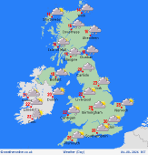
For the weather for the next few days click here
 Monday 3/8/26 Monday 3/8/26
A complex and shallow area of low pressure lingers to the southwest of Ireland, bringing rain and heavy showers, a risk of local thundery downpours. Ireland, southwest England and Wales into southern Scotland are indicated to see most outbreaks of rain. A drier, brighter day in the east of England, but the rain is likely to move eastwards into the evening and night with some thunderstorms for eastern and northern England possible. Feeling humid once again. Highs to 32C south, 19 to 22C northern England and Ireland, nearer 17 to 19C Scotland.
 Tuesday 4/8/26 Tuesday 4/8/26
Tuesday continues to bring outbreaks of heavy rain to Scotland, northern England, and Ireland, a few thundery downpours. A few breaks in the rain here and there, starting driest across England, particular in the east. However, afternoon brings an increased risk of afternoon showers, most areas at risk, but local bright drier windows. Highs at 16 to 31C.
 Wednesday 5/8/26 Wednesday 5/8/26
Wednesday sees more showers across all areas, most concentrated with heavy bursts in Scotland with some risk of thunder. Sunny spells between the showers, the best of dry bright windows to the south and east. Highs 16 to 28C, warmest in the south and east.
 Thursday 6/8/26 Thursday 6/8/26
Pressure on the high side on Thursday but generally slack in nature; a bright morning for many gives way to afternoon showers, most notably along coastal areas with a risk of heavy downpours. Highs 17 to 27C, warmest south.
Friday 7/8/26
Showery for most on Friday, the showers heavy with a risk of thunder in England. Becoming quite windy too with strong gusts forming around showers. An easing trend late in the day. Highs at 16 to 26C.
Saturday 8/8/26
Pressure rising with bright spells breaking out for many. A few showers continue to affect northern coastal areas, particularly northern Scotland. A brisk northerly breeze with highs at 17 to 24C.
|
