|
 Monday Monday
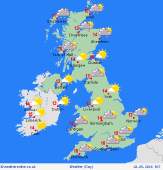
A zone of showery rain moves south over north-central England and Wales early in the day, breaking into scattered showers over southern counties by the afternoon, but an odd heavier shower toward the southeast. Brighter skies extend from the north to give sunny spells. Local brief showers for northern Scotland, snow flurries on the hills, but mostly dry for Scotland and Northern Ireland. Drizzly rain reaches northwest Scotland later. Chilly northerly breezes. Highs 9 to 13C.
 Monday night Monday night
Rain and drizzle affects north and western Scotland into the night, patchy rain extending into the northwest of Ireland becoming more persistent. Small amounts of rain reach eastern Scotland. Dry with clear skies over much of England and Wales, thickening cloud in northwestern areas, may bring a little rain by dawn into Cumbria. Light winds in the south, freshening westerly breezes in the north. Lows near 0C, or just below in rural areas; nearer 5C coasts, also the cloudier north.
 Tuesday Tuesday
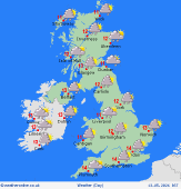
A front passing southeastwards during the day brings a band of rain over an hour or so, affecting more northern areas in the morning, then becoming patchier as it reaches central-southern areas into the afternoon, though still some locally heavier bursts. A scattering of showers follow across Scotland and Ireland, some heavy particularly eastern Scotland in the afternoon. Fresh westerly winds, feeling cool. Highs 11 to 13C north and west, up to 15 or 16C in central-eastern England.
 Wednesday Wednesday
Low pressure east of the British Isles on Wednesday. A cold and showery northwesterly flow. This brings frequent and heavy showers, some of hail and thunder. Showers most frequent toward the north and west in the morning, but breaking out widely during the day, tending to shift eastwards in the afternoon. Fewest showers toward southwest England. Brief moments of sunshine. Brisk and chilly winds. Highs at 9 to 14C, mildest in the far south of England.
|


