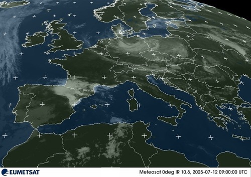
UK Forecast- July 11, 2025
Dry and sunny
Locally hot south
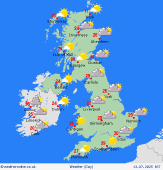
 Saturday
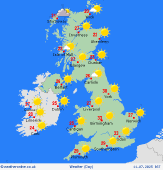
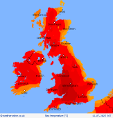
A dry and sunny day is expected across the British Isles. High pressure shifts eastward and easterly breezes will pick up, though still quite warm from a continental source: temperatures will peak at 31C in the southwest near Somerset/south Wales, some central areas of Ireland and Scotland also reaching 30C. East coasts will be cooler in the North Sea breeze, reaching 24C.
 Saturday Night
A dry evening and night with mostly clear skies. Only some patchy cloud around the east coast of Britain, more extensive cloud building in the south and west of Ireland. The easterly breeze continues to prevail, allowing better overnight cooling than previous night: lows will reach 13C eastern Britain, 15 or 16C south and west areas.
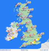
 Sunday
Cloud soon builds across most areas on Sunday, though sun spells will still be common over Britain. Rain into southwest Ireland in the morning slips northward with a few patches reaching east into Wales and northwest England/southern Scotland later in the day. Risk of heavy bursts increases through the day. Highs will reach 29C south/central areas of England, 27C central Ireland and Scotland, 25C east coasts up into Scotland.
 Monday
Showery rain often in Ireland with heavy bursts and winds rising through the day. Often raining for a time as well in north England and Scotland - risk of heavy rain with odd thundery flashes in the morning. Rain will generally relegate to central and north Scotland later in the day with only a few spots continuing to drift onto western coasts southward into southwest England. Decent sun spells will arise everywhere between spells of rain. Highs will reach 28 or 29C in southeast England, 17C northwest, Scotland, and Ireland.
|